100 Florida Trails®
Top FL Multi-use Bike Trails
Map Links & Photos Galore
Coast-to-Coast Updates
You are here >
Home >
FL Eco-biking >
Inglis Dam Recreation Area
Latest update: August 2022
Biking at Inglis Dam & Island Recreation Area, Florida
Paved Bike Trail Adds to Recreation Options
Near Florida's Gulf coast, west of Dunnellon and north of Crystal River, there are 3 State Recreational Areas here (see State brochures below), all part of the Marjorie Harris Carr Cross Florida Greenway. Most popular is the Inglis Dam & Island Recreational Area, offering paved and unpaved biking, hiking, and other amenities. (Map link and photos below.)
Location: Levy County
Mileage: 2.5 mile paved bike trail, plus 7.5 miles unpaved
Surface: Mixed (paved, grass)
Nearby Points of interest: Inglis Dam and Lock
Bike Shops/Rentals:
N/A
Page Summary:
- A Quick History... from Barge Canal to Greenway
- Inglis Dam & Island Recreation Area
- Inglis Island, Inglis Island Bike Path - Inglis Bypass Recreation Area
- Dam and Bypass Canal, Bypass Recreation Area - Inglis Lock Recreation Area
- Inglis Lock, Lock Recreation area - More Information and Resources
A Quick History... from Barge Canal to Greenway
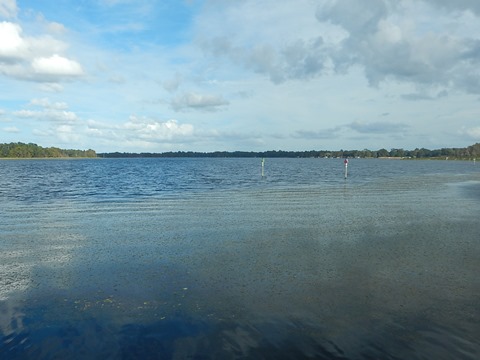
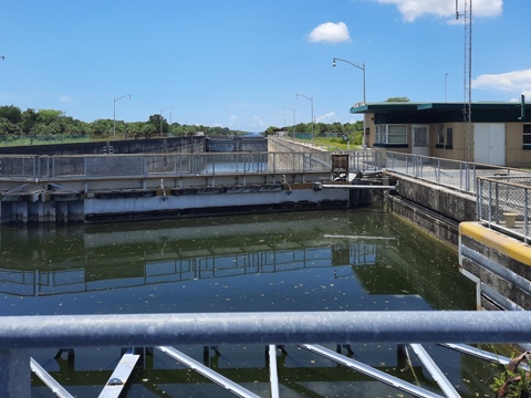
The Inglis Dam was built in the early 1900's to provide hydroelectric power to the phosphate mining boom in the area. The dam blocked the Withlacoochee River, creating Lake Rousseau (12 miles long, 3,700 acres), popular for fishing. A hydroelectric plant operated from 1909 to 1965. A new (non-hydroelectric) dam was built when the lake was incorporated into the Cross Florida Barge Canal project in the 1960's. The Withlacoochee River was bisected by a section of the Barge Canal, so a smaller "Bypass Canal" and dam were built to allow fresh water into the north section of the river cut off by the Barge Canal. A lock system was added below the bypass canal to maintain water levels on the lake.
The canal project was halted in 1971 due to environmental concerns. In 1990, the lands were turned over to the State of Florida for conservation and recreation. In 1998, the land was renamed the Marjorie Harris Carr Cross Florida Greenway in honor of the person who led opposition to the project. Due to the layout of the waterways here, the State created three separate Recreation Areas.
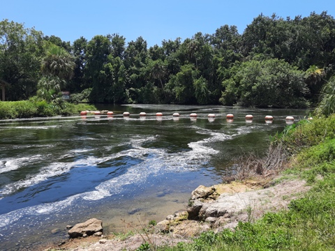
Inglis Dam & Island Recreation Area... Most Popular, Bring Your Bike
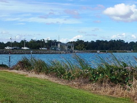
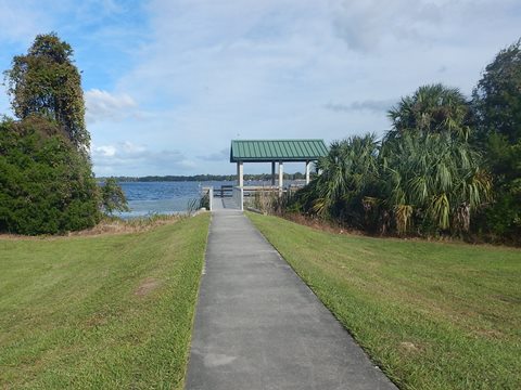
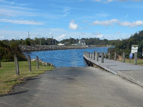
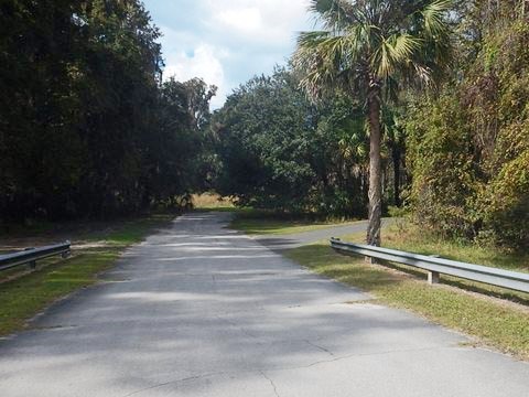
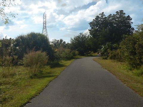
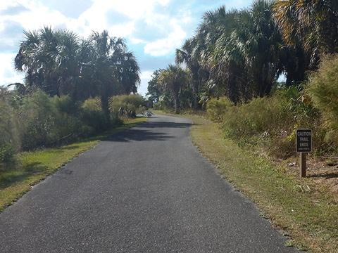
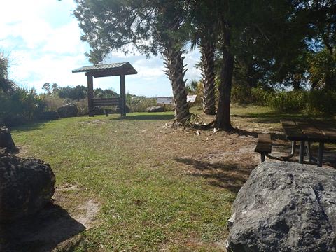
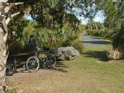
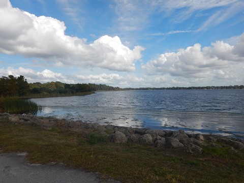
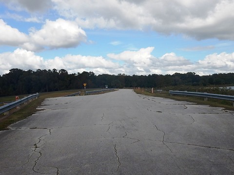
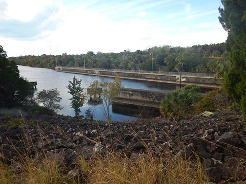
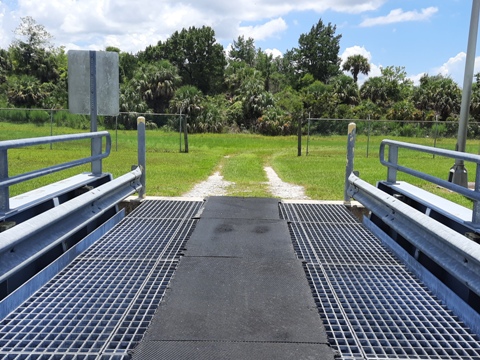
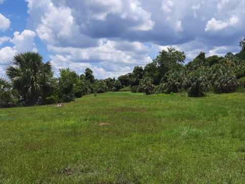
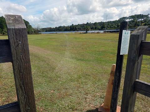
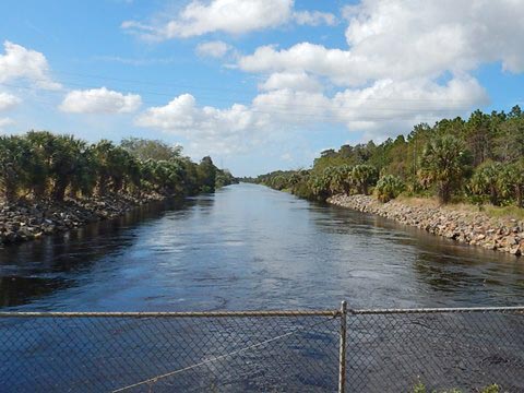
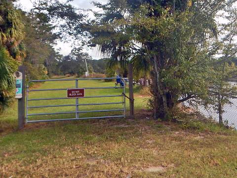
On the south side of the Barge Canal, this is the largest and the most popular of the three Recreational Areas. The main access is at the Bessie Smith Prescott Memorial, off W. Riverwood Drive, east of US19/98. Amenities include paved parking, 2 boat ramps (above and below the dam), restrooms, picnicking, and 3 small fishing piers. A walkway over the dam leads to Inglis Island, which offers a 2.5 mile multi-use bike trail, plus 7.5 miles of unpaved trail (mowed grass - a workout), and an equestrian staging area.
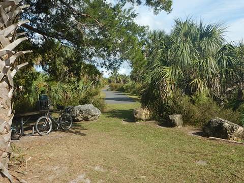
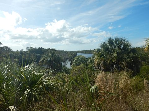
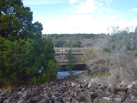
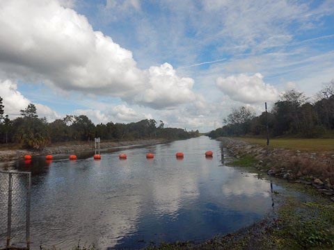
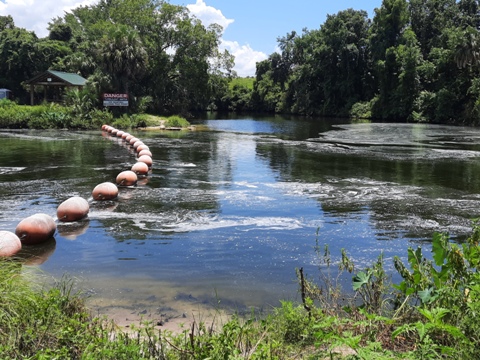
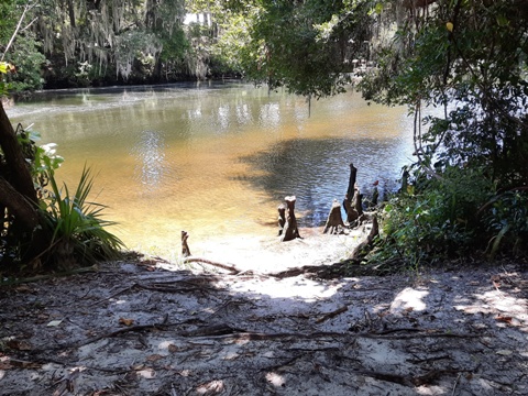
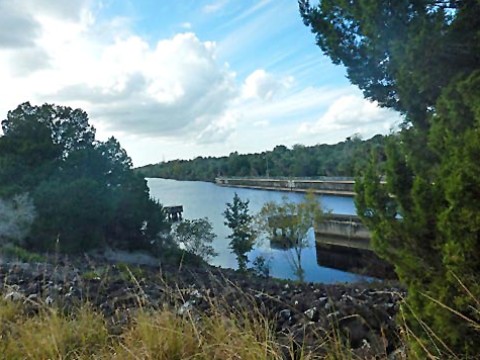
Inglis Island
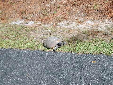
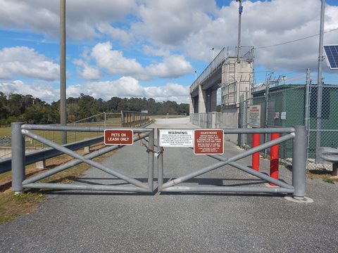
Starting from the Dessie Smith Prescott Memorial area on Lake Rousseau, take the walkway over the dam to Inglis Island. Note: while it appears to be gated, there is a pedestrian walk-through. The 1,200 acre island is bounded by Lake Rousseau, the Cross Florida Barge Canal, and the Withlacoochee River (see map).
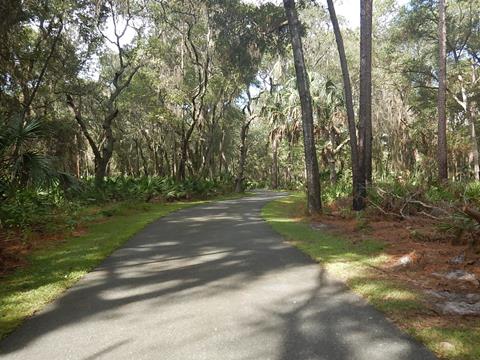
Inglis Island Bike Trail
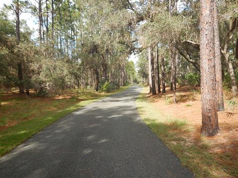
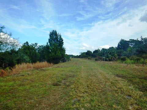
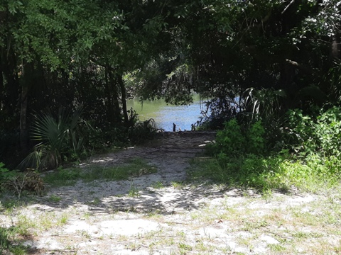
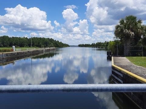
The 12' paved bike trail is 2.5 miles one-way. Leaving the dam at Lake Rousseau, the trail first goes through a pleasant wooded area, then parallels the Barge Canal to the end overlooking the juncture of the Withlacoochee River and Cross Florida Barge Canal. Another 7.5 miles of unpaved trail cross and parallel the paved trail
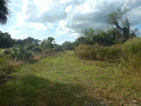
More Views of Inglis Island
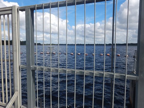
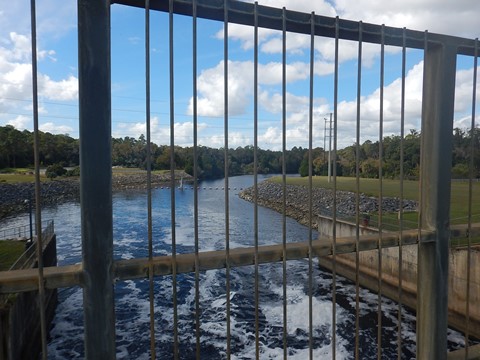
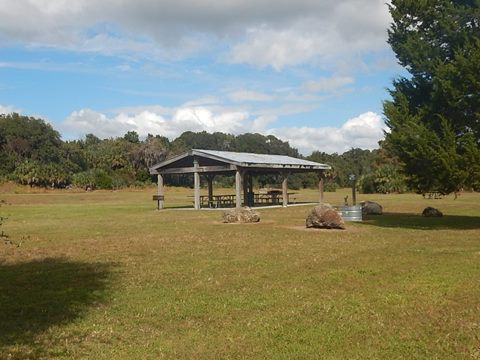
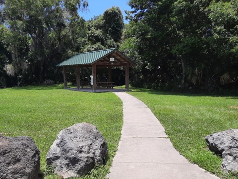
From the walkway over the dam are views of the spillway and Withlacoochee River on one side, and Lake Rousseau on the other. Shortly after getting onto the island is the equestrian staging area with picnic pavilion and portalet. A grassy trail off the paved bike path follows the Barge Canal to Inglis Lock and beyond.
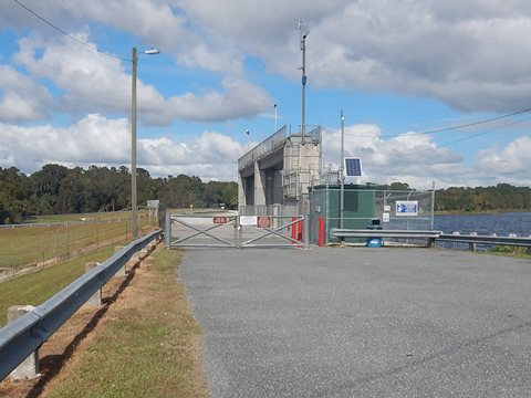
Inglis Bypass Recreation Area... A Second Dam is Here
Two smaller State Recreation Areas are located on the north side of the Barge Canal, off SR40 east of US19.
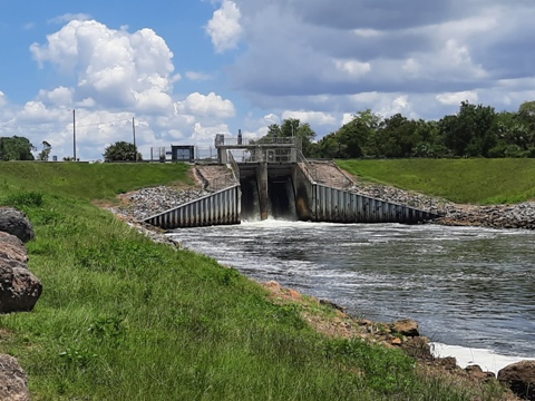
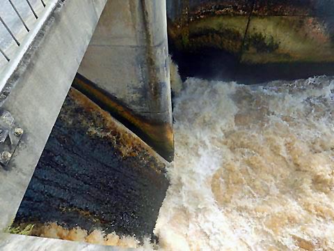
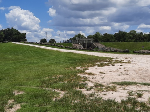
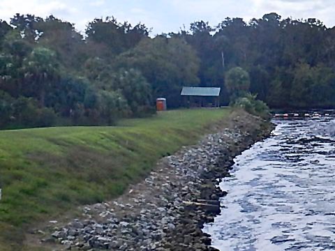
At the Inglis Bypass Recreation Area, the bypass dam and spillway are the dominant features - picnicking and fishing are popular. There is a spot to hand-launch a kayak onto the Withlacoochee River (formed anew by water from the bypass canal). There are also miles of hiking trail (mowed grass, little shade) between the two canals (see map).
Dam and Bypass Canal
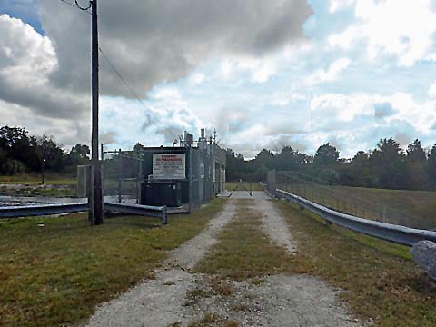
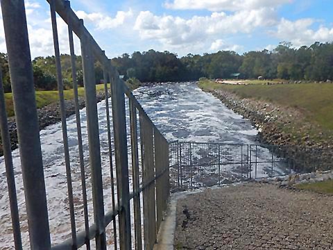
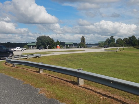
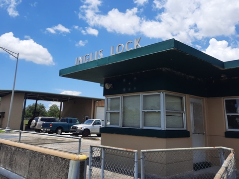
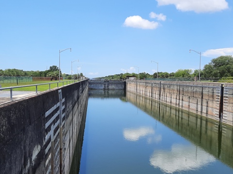
Inglis Lock Recreation Area
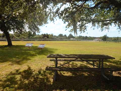
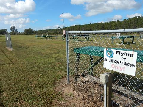
On the north side, situated between the Bypass Canal and the main Barge Canal, about 1/2 mile east of the bypass dam. Views of canal and lock (non-operational). A steel bridge at the lock crosses the canal to Inglis Island, where a grassy trail connects to the paved bike trail. The Recreation Area has parking, picnic, portalet, a large open grass field, and hiking (mowed grass) between the two canals. The Cross Florida Greenway West Zone field office and maintenance facilities are located here. A model airplane club operates adjacent. An annual music festival is held in the open field.
Inglis Lock
More Information and Resources
Nearby Biking:
Marjorie Harris
Carr Cross Florida Greenway
Withlacoochee Bay
Trail
North FL Region - More
trails plus Regional Overview map
Nearby Paddling:
Withlacoochee River (South) at PaddleFlorida.net
Related Resources:
Florida State Parks - Inglis Dam & Island Recreation Area
Florida State Parks - Inglis Bypass Recreation Area
Florida State Parks - Inglis Lock Recreation Area
Find Trails by FL Region or Listed A - Z

100FloridaTrails.com... 100+ Florida Multi-use Bike Trails, Best for Safe, Fun Recreation and Fitness
Other Websites:
BikeOrlando.net
PaddleFlorida.net
BikeTripper.net
Copyright © 100FloridaTrails.com. All Rights Reserved.