100 Florida Trails®
Top FL Multi-use Bike Trails
Map Links & Photos Galore
Coast-to-Coast Updates
You are here > Home > FL Eco-biking > Lower Suwannee National Wildlife Refuge
Lower Suwannee National Wildlife Refuge, Florida...
Overview of Top Biking and Hiking Options
The Lower Suwannee National Wildlife Refuge is located at the southern end of Florida's Big Bend in Levy and Dixie Counties, on both sides of the Suwannee River. The Refuge, covering 53,000 acres including the last 20 miles of the Suwannee River and 30 miles along the Gulf of Mexico, has a dual purpose: (1) to protect the water quality of the historic Suwannee River as it flows into the Gulf of Mexico, and (2) to protect and restore habitat lost to early logging operations (more below). Activities include hiking, biking, paddling, fishing, wildlife viewing and birdwatching (over 250 species identified). Closures can occur due to weather or other factors, check for status . (Map link and details below.)
Location: Dixie and Leon Counties
Mileage: Varied
Surface: Limestone, gravel, grass
Nearby points of interest: Suwannee River, Cedar Key,
Shell Mound
Support and Advocacy:
Friends of the Lower Suwannee and Cedar Keys National Wildlife Refuges
Overview of Eco-biking and Hiking at Lower Suwannee NWR... Comments and Links
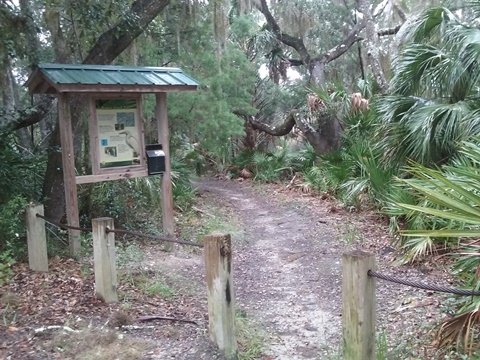
Biking is allowed on designated public roads and behind locked gates. Hiking is permitted in all areas open to the public. Camping and horseback riding are prohibited. Hunting is allowed (permit required). Areas are shaded, but sunscreen recommended. Insect repellant is a must here, especially in the summer.
This is a remote area and some may not find it particularly scenic, but we found it to have a natural beauty that is compelling in its simple way with a lot of history to tell. We both biked and hiked in areas on both sides of the Suwannee River, see links below for details.
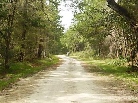
 Dixie Mainline Trail - On the north side of the Suwannee River, 9-mile limestone road along Florida's Big Bend (former logging road), between
Horseshoe Beach and Suwannee. Open to cars, bikers and hikers.
Dixie Mainline Trail - On the north side of the Suwannee River, 9-mile limestone road along Florida's Big Bend (former logging road), between
Horseshoe Beach and Suwannee. Open to cars, bikers and hikers.
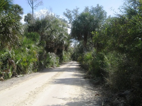
 Lower Suwannee Nature Drive
- On the south side of the Suwannee River, 9-mile limestone road (former logging road) open to cars, bikers and hikers. Varied habitat and
wildlife observed. Boat ramp, observation deck.
Lower Suwannee Nature Drive
- On the south side of the Suwannee River, 9-mile limestone road (former logging road) open to cars, bikers and hikers. Varied habitat and
wildlife observed. Boat ramp, observation deck.
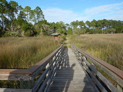
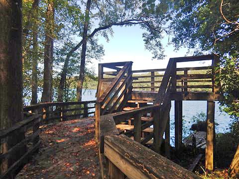 River Trail Loop - At the
Refuge Headquarters, at north end of Lower Suwannee Nature Drive. 3/4 mile hiking loop includes boardwalk and an overlook on the
Suwannee River - the only trail within the Refuge that goes to the
River. Connects to 2 miles of additional hiking trail.
River Trail Loop - At the
Refuge Headquarters, at north end of Lower Suwannee Nature Drive. 3/4 mile hiking loop includes boardwalk and an overlook on the
Suwannee River - the only trail within the Refuge that goes to the
River. Connects to 2 miles of additional hiking trail.
 Shell Mound -
Archaeological site near Cedar Key, FL. Hiking trails include a short walk to the top of a large Indian shell mound. Nearby pier and observation deck, campground and boat ramp.
Shell Mound -
Archaeological site near Cedar Key, FL. Hiking trails include a short walk to the top of a large Indian shell mound. Nearby pier and observation deck, campground and boat ramp.
More Information and Resources
More about the Refuge:
This area of north Florida was logged out many times, leading to the loss of the pristine forests and marsh. Non-native pine was planted for commercial use, replacing the native species. Restoration projects are ongoing to return the native long-leaf pine and sawgrass.
Nearby Biking:
Town of Cedar Key
North FL Region - More
trails plus Regional Overview map
Nearby Paddling:
Lower Suwannee River
Cedar Key-Hog Island
Related Resources:
U.S. Fish & Wildlife Service - Lower Suwannee National Wildlife Refuge
Find Trails by FL Region or Listed A - Z

100FloridaTrails.com... 100+ Florida Multi-use Bike Trails, Best for Safe, Fun Recreation and Fitness
Other Websites:
BikeOrlando.net
PaddleFlorida.net
BikeTripper.net
Copyright © 100FloridaTrails.com. All Rights Reserved.