100 Florida Trails®
Top FL Multi-use Bike Trails
Map Links & Photos Galore
Coast-to-Coast Updates
You are here >
Home >
FL Eco-biking >
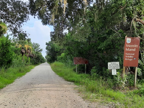
Merritt Island National Wildlife Refuge
Latest update: February 2024
Merritt Island National Wildlife Refuge... Florida
Nationally Known for Birdwatching - Hiking, But Less Biking Today
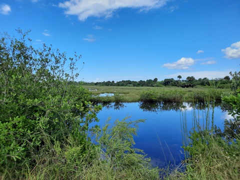
Merritt Island National Wildlife Refuge is fun eco-biking (where possible now) due to its unique character and beauty. Biking here is not ideal, but where possible provides unmatched enjoyment of nature at a speed that expands your views. Established in 1963 as part of the development of Canaveral (John F. Kennedy) Space Center, the Refuge consists of 140,000 acres that provide habitat for over 1,500 species of plants and animals. The earthen berm roads are unpaved, some open to cars, some not, all great for wildlife viewing - especially bird watching - in the winter months. Bikes are discouraged on Black Point Wildlife Drive and prohibited on hiking trails throughout the Refuge. Fishing requires a Refuge Fishing Permit. Occasional closures due to rocket launches. (Map link and photos below.)
The information presented here is subject to change due to storm damage, area closures, and Refuge policy. Check for current closures
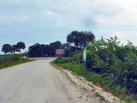
Location: From Titusville, SR 406, go east over the Max Brewer Causeway Bridge and the entrance to the refuge is on the left, or go straight to the Visitor Center. From the north, from US 1 near Oak Hill take SR 3 southbound. The Visitors' Center is located on SR 402, 5 miles east of US 1 in Titusville (Mon-Fri: 8:00 a.m. to 4:30 p.m.)
Nearby points of interest: Manatee Observation Deck, Kennedy Space Center, Canaveral National Seashore, Playalinda Beach
Activities include fishing, boating, kayaking, hiking and biking
Bike Shops/Rentals/Tours:
Ten Speed Drive Bicycle Center (Titusville, sales, service)
Bubba's Pampered Pedalers (group bike tours)
Support and Advocacy:
Merritt Island Wildlife
Assn.
Page Summary:
- Eco-biking and Hiking at Merritt Island National Wildlife Refuge
- Black Point Wildlife Drive
- 7 miles one-way auto tour - Biolab Road
- 6 miles one way, exits at Canaveral National Seashore - Gator Creek Network
- 6 miles, Gator Creek Road east and west, Catfish Creek Road
- 2.5 miles, Peacocks Pocket Road - L-Pond Road
- 5.5 miles on dikes along Dummitt Cove and the Indian River - Shiloh Marsh Road
- 11 miles, short section open to traffic for fishing and small craft launching - 7 Hiking Trails (no bikes)
Cruickshank, Wild Bird, Birdhouse, Palm Hammock, Oak Hammock, Pine Flatwood, Scrub Ridge - Wildlife
- More Information and Resources
Eco-biking and Hiking at Merritt Island National Wildlife Refuge... Comments and Photos
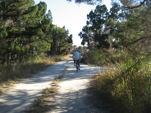
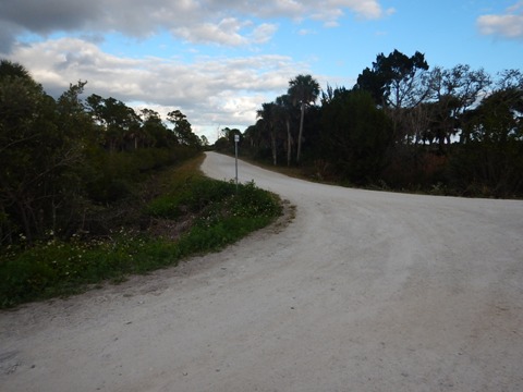
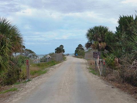
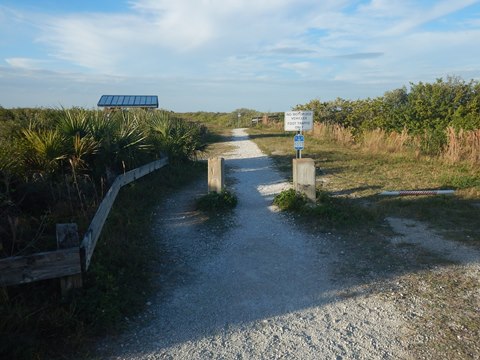
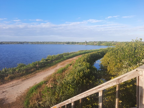
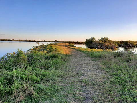
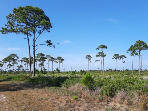
While biking is allowed on park roads (prohibited on SR 406 from 6-8 a.m. and 3-5 p.m.), we do not recommend biking on the paved main roads due to traffic, high speed limits, no shoulders, and no bike lanes. This is wide-tire biking on hard-packed dirt and grass roads on the earthen berms that shape the water impoundment areas. Originally created for mosquito control, the Refuge has become one of America's premier bird-watching areas. Some roads are open to cars, some are not. Roads closed to cars soon become grassy, getting more overgrown beyond the distance typically walked by fishermen and birdwatchers. Here the biking itself is less than ideal, but the solitude, fresh air, and scenery can be wonderful. Weather is key to enjoyment - best when cool, dry, and sunny. Bring water, sunscreen and insect repellent. We report on 5 Refuge areas with a variety of biking, We also explored the Refuge hiking trails.
Disclaimer: Conditions are subject to change due to storm damage, maintenance, and Refuge policy. Hopefully useful, our descriptions are but a glimpse in time.
Black Point Wildlife Drive - 7 miles
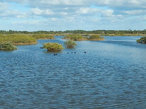
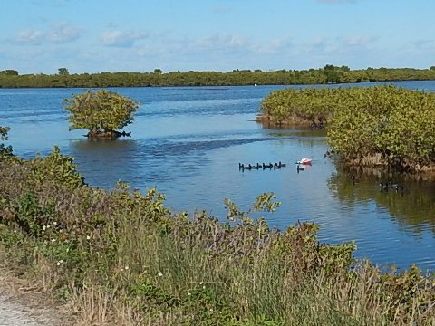
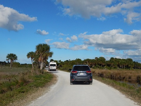
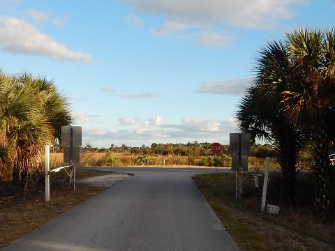
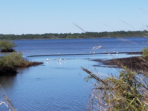
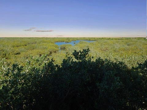
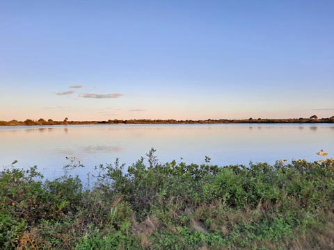
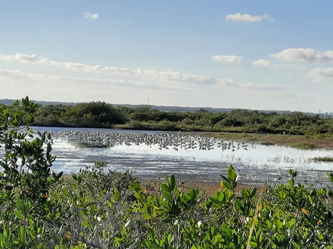
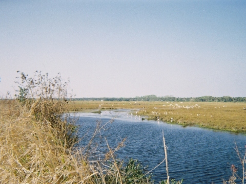
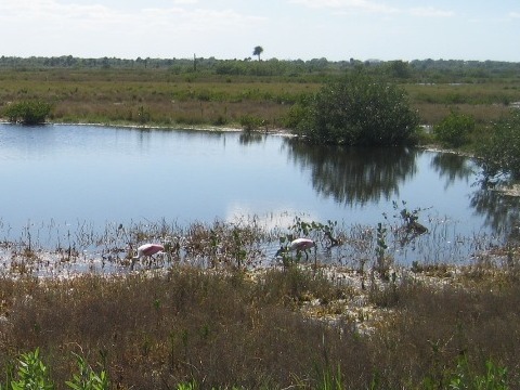
One of the most popular attractions in the Refuge, the 7-mile drive runs one-way, starting and ending along Max Brewer Memorial Pkwy. Bikers and hikers are discouraged from using Black Point Wildlife Drive. When driving, be sure to observe the low speed limit and keep alert as other drivers can be distracted by birdwatching. The drive can be exceptionally busy on weekends, it's best to visit on weekdays. Fee applies - pay box at entrance. With 330 varieties of birds counted, this is one of the premier birding areas in the world and draws many winter visitors.
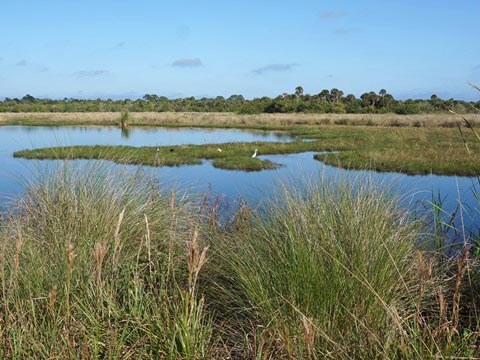
Max Brewer Memorial Pkwy. to Cruickshank Trailhead
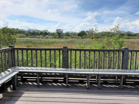
This is the most picturesque section of Black Point Wildlife Drive and the best birdwatching and wildlife viewing, with unobstructed views from the dikes around the marsh impoundments. About 2 miles from the start, visit Wild Bird Trail - short but scenic trail with 2 observation decks (see hiking, below).
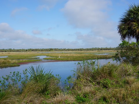
Cruickshank Trailhead Back to Max Brewer Memorial Pkwy.
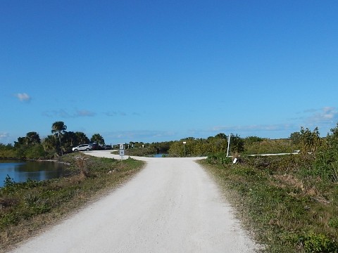
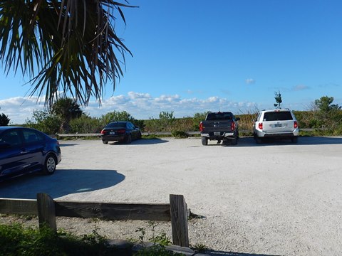
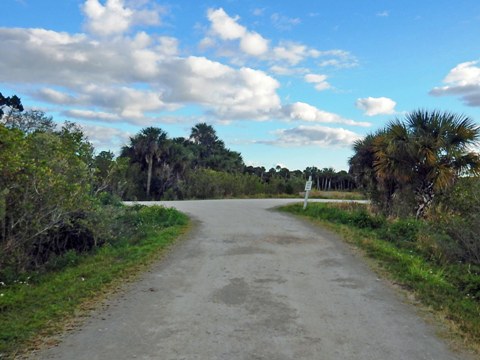
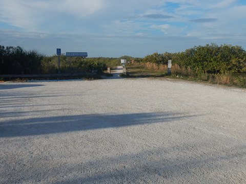
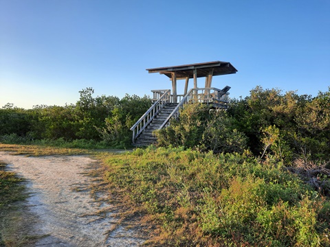
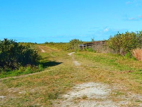
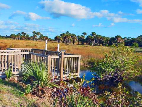
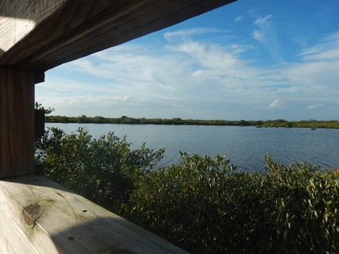
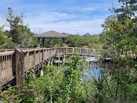
At about midway along the Drive is the Cruickshank Trailhead with parking and restrooms, an Observation Tower and observation deck. The 5-mile Allan Cruickshank Memorial Trail (see hiking, below) starts and ends here. Continuing on the Drive, the final section past the intersection with L-Pond Road (more information below) becomes less scenic as the pine flatlands in this section tend to block the view.
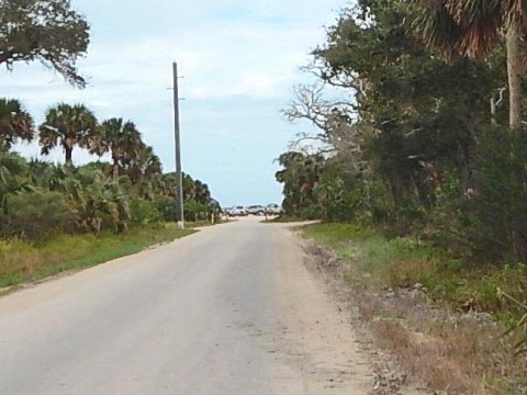
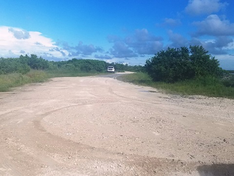
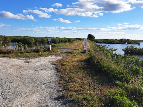
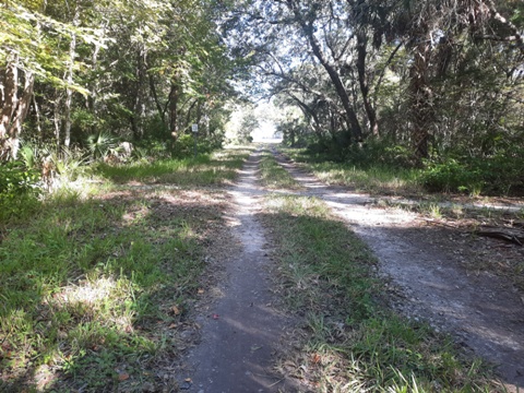
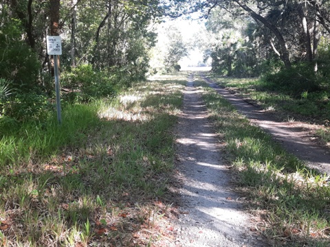
Biolab Road Scenic Drive - 6 miles
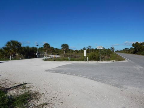
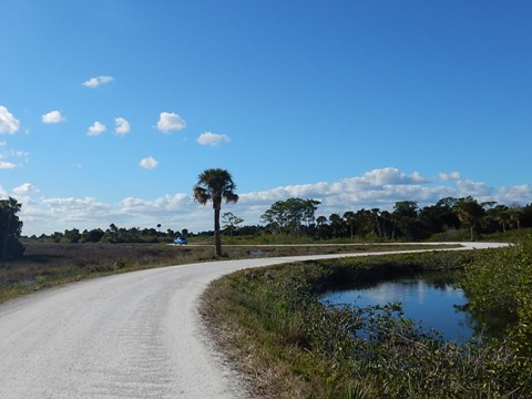
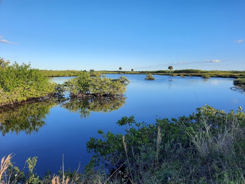
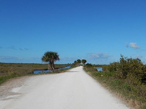
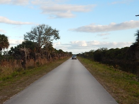
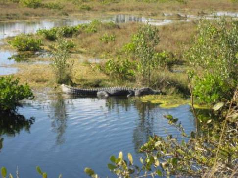
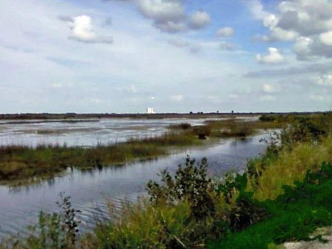
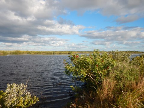
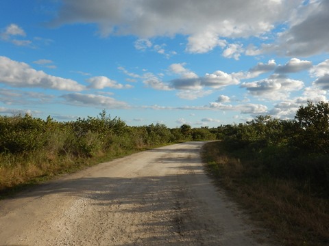
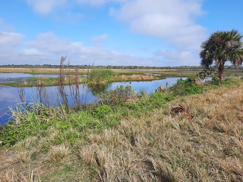
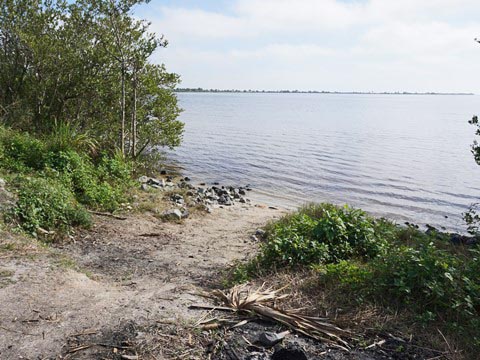
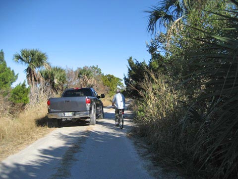
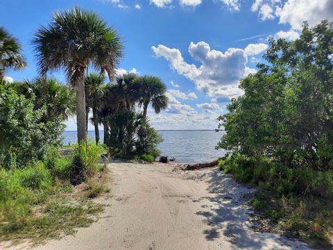
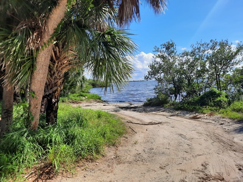
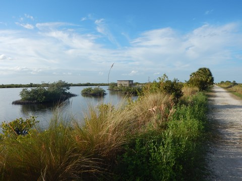
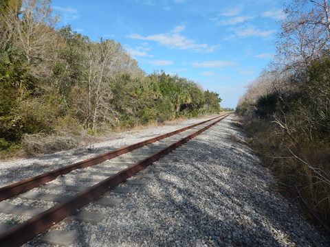
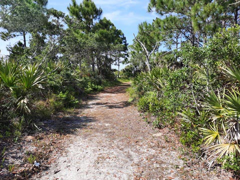
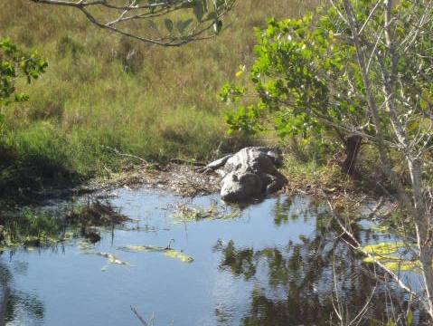
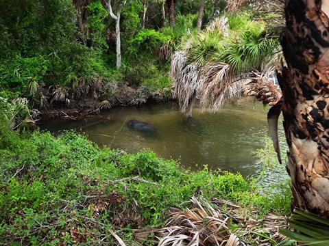
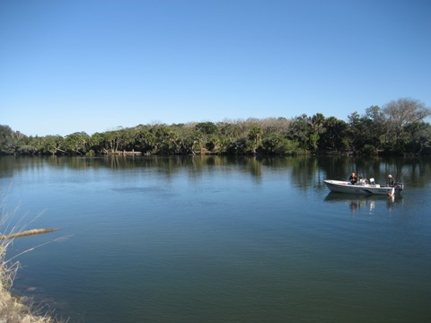
A biking option is on Biolab Road scenic drive, 6 miles one-way for vehicles from north to south (except for a short section near the south end). The entrance to the drive is off Kennedy Parkway/SR 3, near the end of Biolab Road just before the parking area for the Biolab Road Boat Ramp (launch fee, kayak launch, no facilities). The drive ends at SR 402 (road to Canaveral National Seashore). Day fee applies for the Scenic Drive (pay box at entrance to the drive). The roadway runs between Mosquito Lagoon and a marsh impoundment, where alligators are often seen. The marsh area at about the mid-section is usually the best place to spot alligators, but not as many birds as the other trails.
The berm roadway is maintained better than Gator Creek or Shiloh Roads, which makes for a more comfortable bike ride. The road is shared with motor vehicles and fishermen. With more cars on weekends, it's best to bike on weekdays. From here you can also see the launch pads at Kennedy Space Center and the vehicle assembly building. Note: about 3/4 mile before reaching SR 402 the road becomes two-way, allowing for access to a fishing area and boat launch - the spur to the launch here is also bikeable.


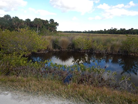
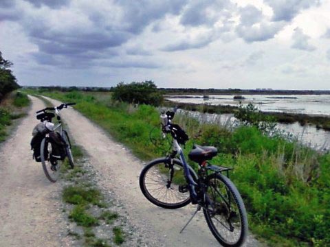
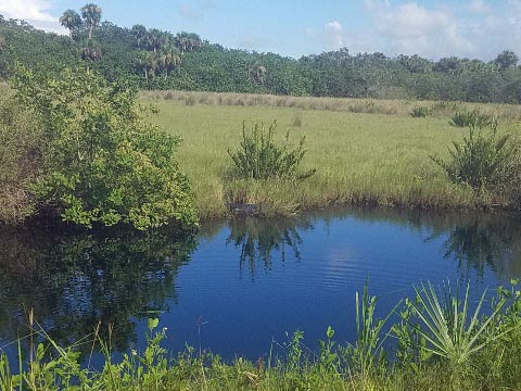
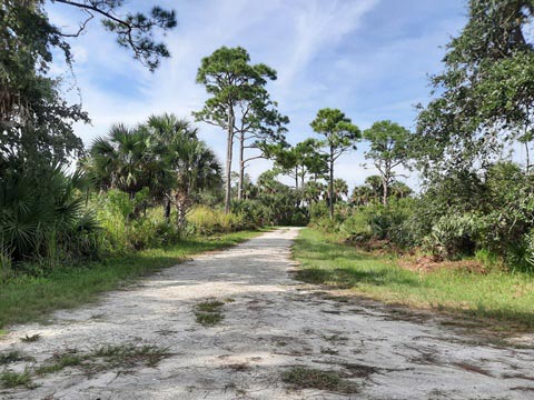
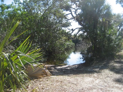
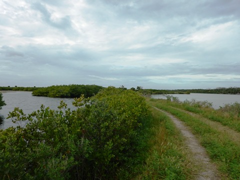
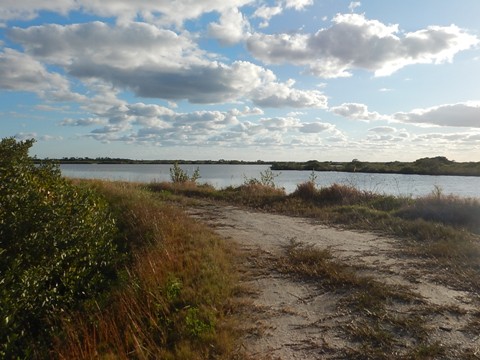
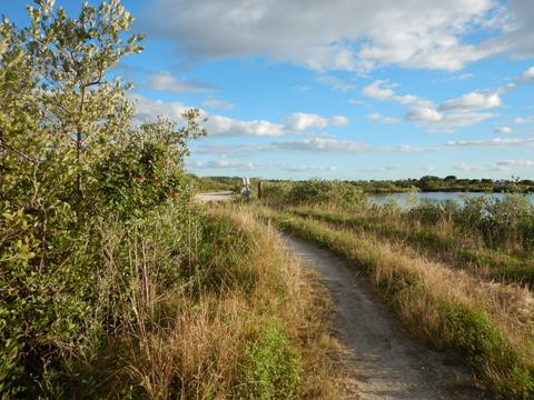
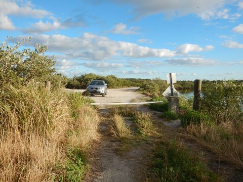
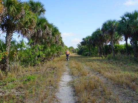
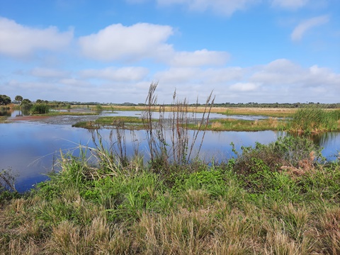
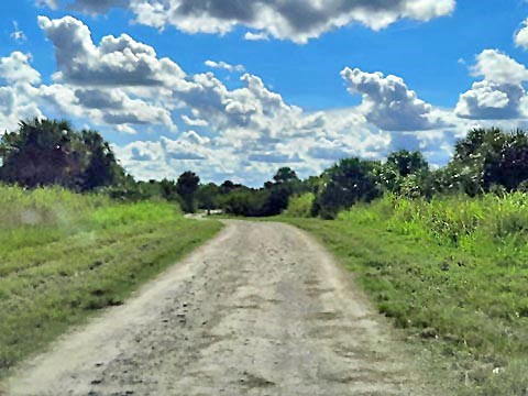
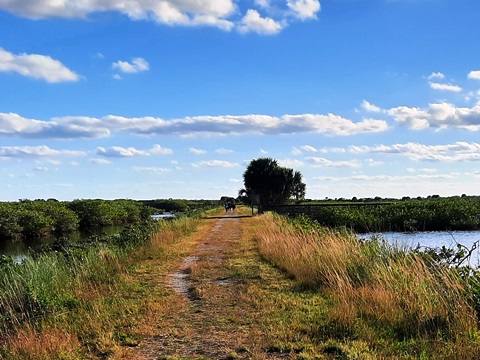
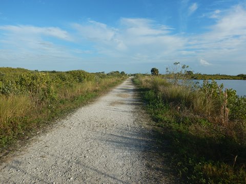
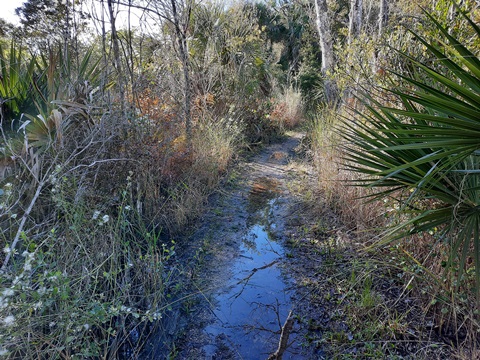
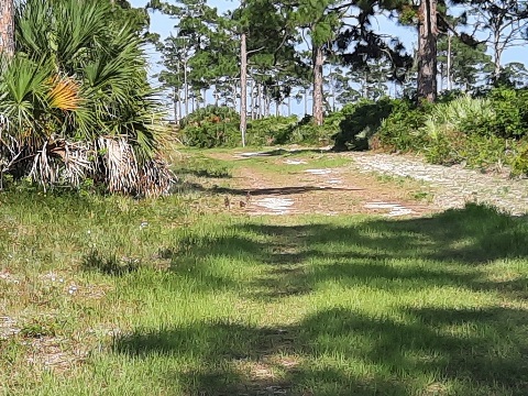
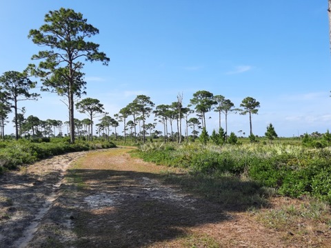
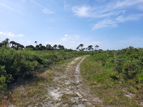
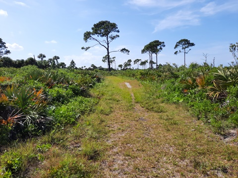
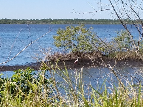
Gator Creek Network - 6 miles
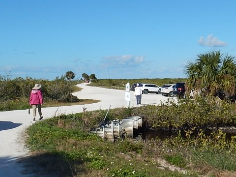
Another option for biking is the network of narrow berm roads at Gator Creek, including Catfish Creek Loop and Peacocks Pocket Road. Can be extremely rutted, so it's spot, stop, and look. Usually some gators and a variety of water birds nearing southern section. This area is south of SR 406, looping east-west from shortly after the causeway to just past of the Refuge Visitor's Center. Usually open to cars but traffic is sometimes blocked at sections, which is an invitation for us. Plenty of birds and alligators make for interesting views.
Gator Creek / Catfish Loop
This section includes East and West Gator Creek Trails and Catfish Creek Loop Trail (6 miles). It starts along Max Brewer Pkwy. (SR 406) across from Parrish Park on the Indian River, and ends back onto SR 406 (East Gator Creek) or SR 402 (West Gator Creek).

Peacocks Pocket Road
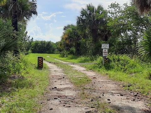
The road starts near the Visitor Center on Max Brewer Pkwy. and runs to Peacocks Pocket on the Indian River (2.5 miles). It once extended along the river to connect to Catfish Loop, but now that section is overgrown (not suitable for biking or hiking) and (sadly) appears to be permanently closed.
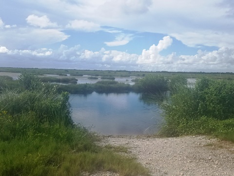
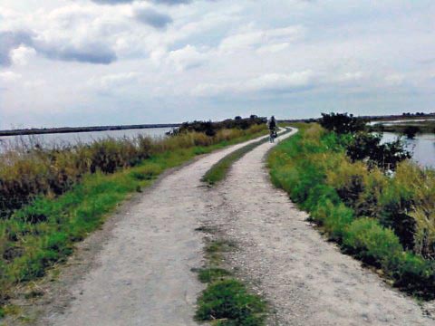
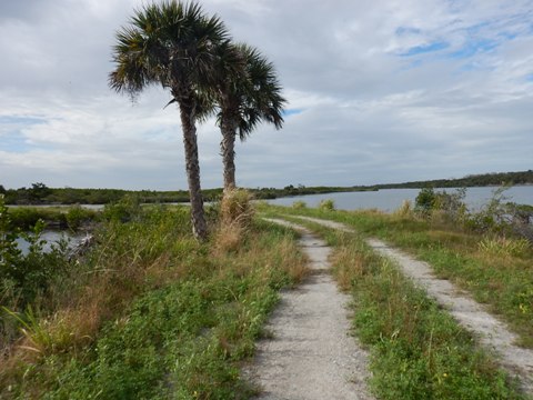
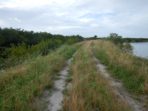
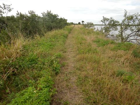
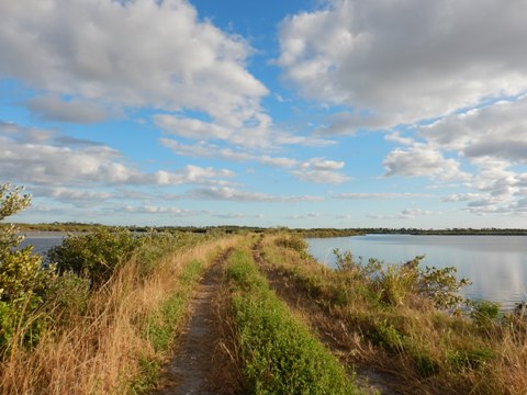
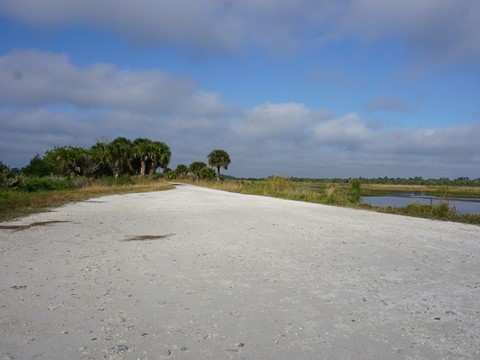
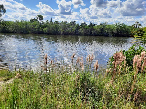
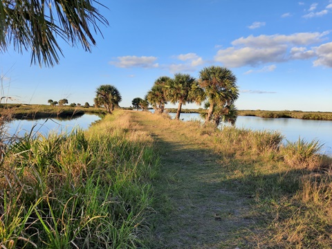
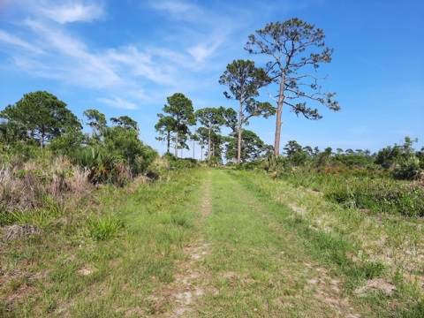
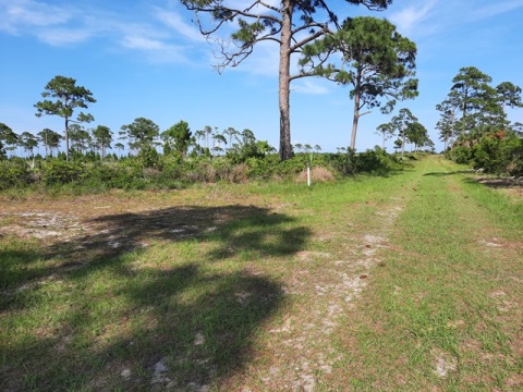
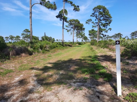
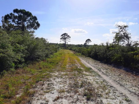
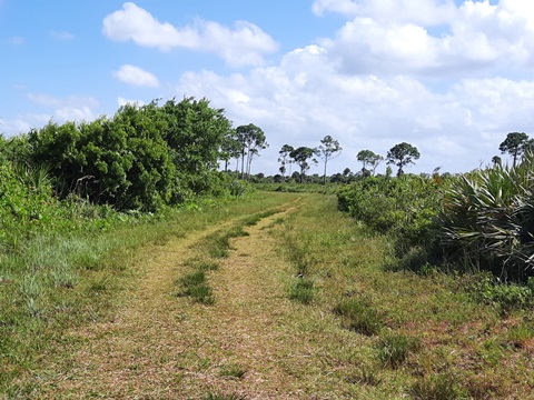
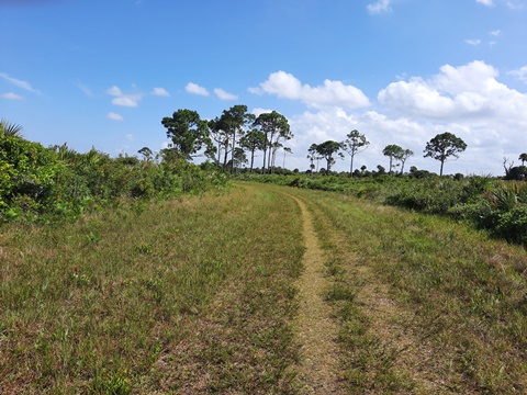
L-Pond Road - 5.5 miles
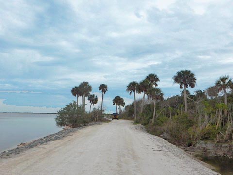
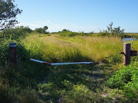
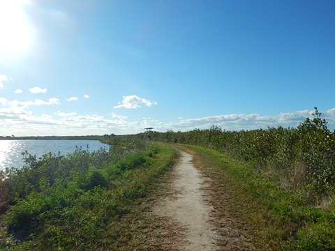
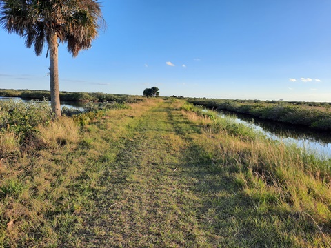
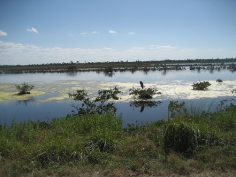
L-Pond Road is (or was) a favorite ride, running on dikes along Dummitt Cove and the Indian River with many birds and outstanding views of the cove and river on one side and marsh on the other. The road totals about 5.5 miles between Black Point Wildlife Drive (about 1.5 miles northeast of the Cruickshank Trailhead) and Kennedy Parkway/CR3 (about 1/4 mile south of Biolab Road). It was overgrown and unbikeable for several years, we were happy to see it had been mowed and was passable. We rode between Kennedy Pkwy. and Wildlife Drive. At the ends, foot traffic - mostly fishermen - keeps the overgrowth manageable, the middle section is more overgrown but bikeable with fat tires. The road is gated off, closed to vehicle traffic but popular for fishing. This also is a waterfowl hunting area, so keep alert during hunting season. Note: This information subject to change due to weather or other factors.
Starting at Kennedy Pkwy.
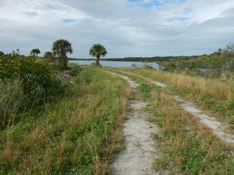
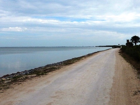
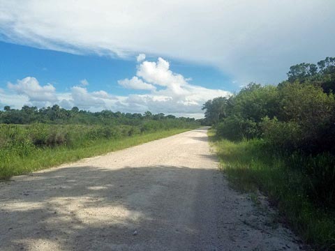
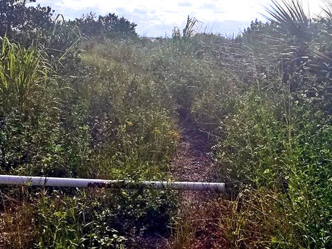
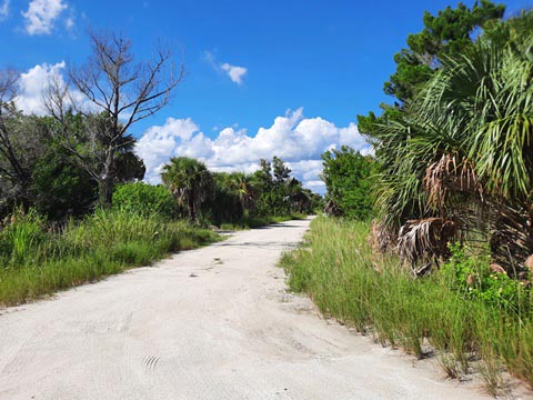
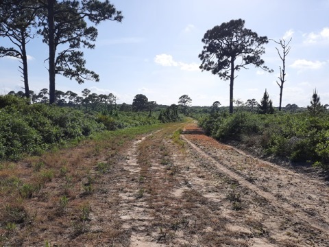
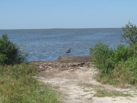
Shiloh Marsh Road - 11 miles
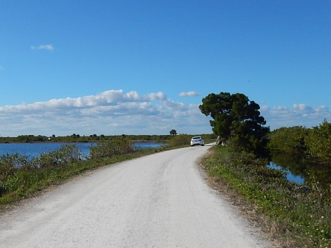
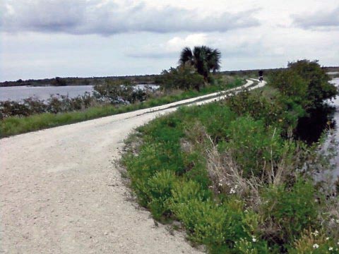
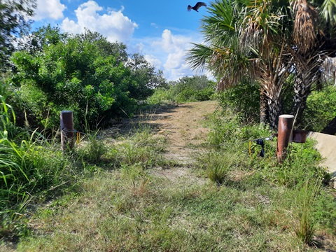
With several entrances off US 1 and SR 3, this road can be biked in sections. Weaving north and south along the shoreline of the Indian River Lagoon, you always have water on both sides. Lots of birds. Great sunsets. Closed to motor vehicles except for a short section at Patillo Creek Road open for fishing and small boat/canoe/kayak launching. Some fishermen but overall quiet. From the northern access off US 1 to Patillo Creek Road the roadway ranges from hard-packed dirt to grass, may be bikeable (or not!) depending on conditions at any given time. The area south of Patillo Creek Road is overgrown and not suitable for biking. No facilities. Areas may be closed due to storms or other factors (check with the Park rangers).
Shiloh Marsh Road - North off US 1
The access road starts off US 1 about 3/4 mile south of the intersection with SR 3. Drive two miles to the parking area and entrance to the dike road between the Indian River and marshes. Popular with birdwatchers and for fishing. We've visited a few times - sometimes rideable, others times not so much. The first half mile is more rideable due to the heavy foot traffic here. Further on, it gets more grassy and depending on weather, overgrowth, or other factors better for hiking. The views, though, make it all worthwhile.
Shiloh Marsh Road, Northern End


Shiloh Marsh Road - Middle at Patillo Creek
Access point is about 1.75 miles south of Taylor Road and 0.75 mile north of the radar globe. This is the only section - about one mile - open to motor vehicles for fishing, or launching small boats, kayaks and canoes. The roadway here is wide and hard-packed, best for biking as it's regularly maintained. Gates shut off the road to vehicles at the north and south ends: to the south, sometimes bikeable on dirt and grass; to the north, mostly overgrown but may be bikeable. Even when the grass is newly mowed, this is not easy biking and perhaps better for hiking (or fishing access).


Shiloh Marsh Road - Southern End
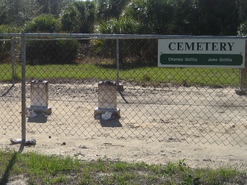
No biking in this section but some interesting stops along the road.
- Look for the big white radar globe, 3/10 mile south of the globe Live Oak Road leads to a parking area for fishing, walking and small boat launch. Shiloh Marsh Road ends at Live Oak Road, not bikeable at this point.
- Several small cemeteries and ruins still exist from the Shiloh community (1800's).


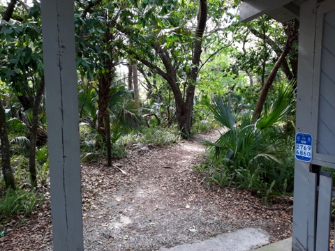
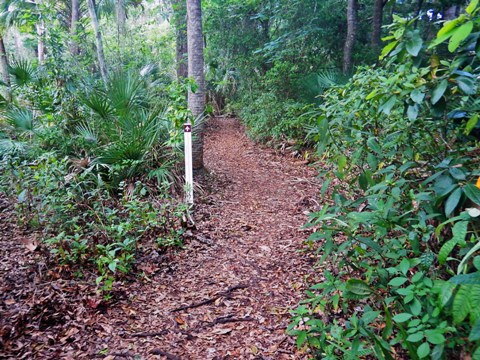
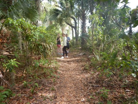
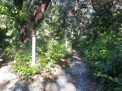
7 Hiking Trails
There are seven hiking trails at the Refuge where bicycles are not permitted. Most are short and not difficult to hike, good to take the kids.
Allan Cruickshank Memorial Trail
The 5-mile Allan Cruickshank Memorial Trail is the longest trail in the Refuge. Two observation decks and a taller Observation Tower offer more expansive views. From the Trailhead parking area and past the gate, turn left to the Observation Tower and trail westbound, or proceed straight to the first observation deck and trail northbound.
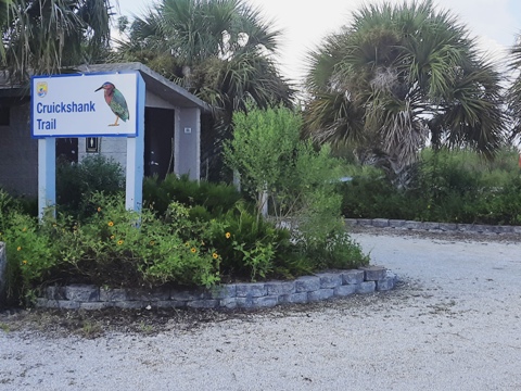
Trail Westbound, Observation Tower

Allan D. Cruickshank (1907-1974) was an ornithologist, naturalist, photographer and teacher who worked at the National Audubon Society for 37 years. As a photographer, he produced wildlife movies and books about birds and other natural subjects. When NASA acquired the land for the Space Center, he envisioned managing the land as a wildlife refuge and influenced the 1963 agreement between NASA and the U.S. Fish and Wildlife Service that created Merritt Island National Wildlife Refuge.
Wild Bird Trail
Along Wildlife Drive about 2 miles from the start is Wild Bird Trail (the trailhead is a short distance along the road past the trail). This 1/3 mile (round-trip) trail, while short, offers 2 observation decks with excellent birdwatching and scenic views. Past the 2nd observation deck the trail is closed to all public entry.


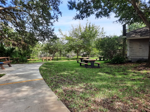
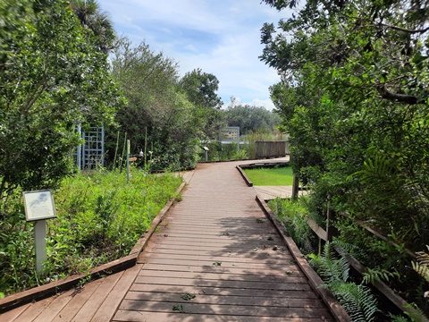
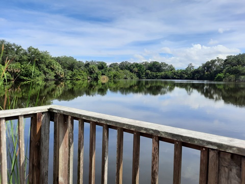
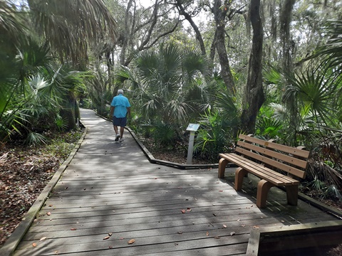
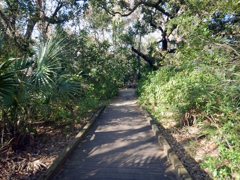
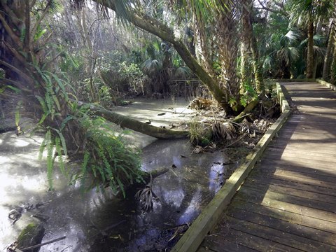
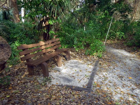
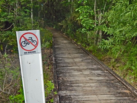
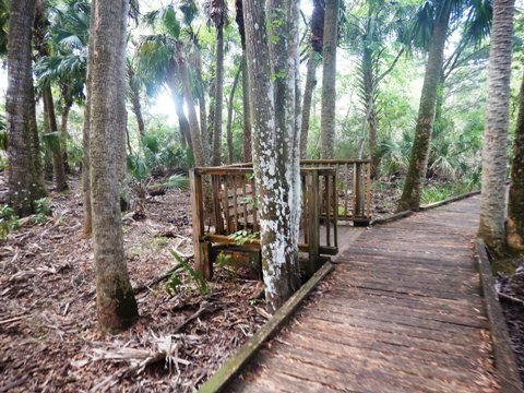
Birdhouse Trail - Boardwalk at the Visitor Center
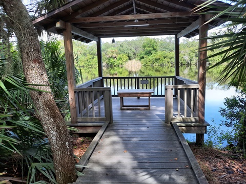
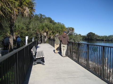
Starting behind the Visitor Center, this is a 1/4 mile loop boardwalk trail. Passing a butterfly garden and two ponds with benches, overlooks and interpretative markers. This is the only handicapped-accessible trail at the Refuge.
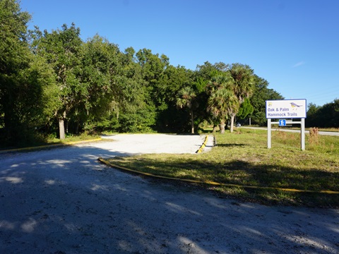
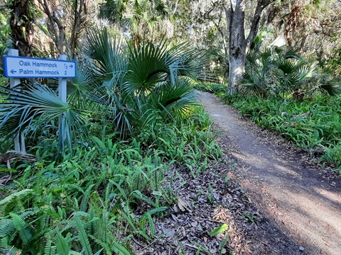
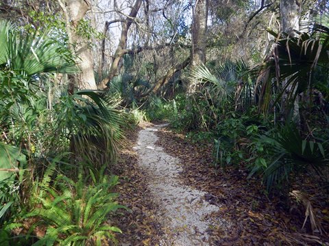
Oak and Palm Hammock Trails
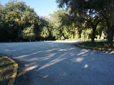
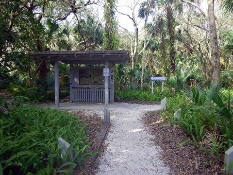
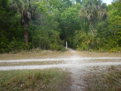
Trailhead and Shared Path
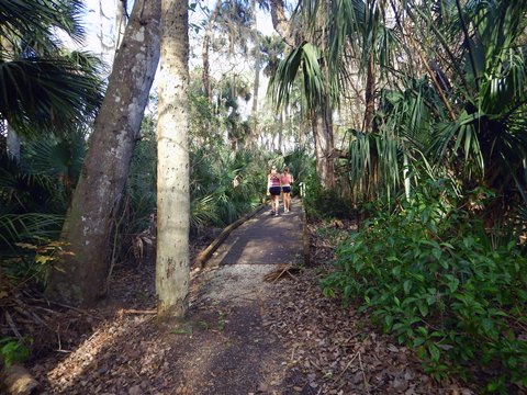
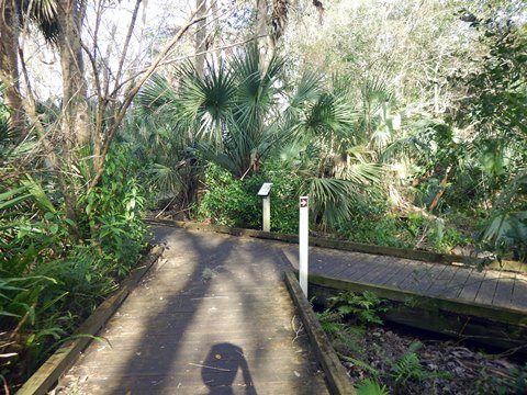
Located along SR 402 about halfway between the Visitor Center and SR3 (Kennedy Pkwy.). The shared trailhead has parking and an information kiosk, no other facilities. From the trailhead, the trails run together for a short distance to the kiosk. Oak Hammock Trail then branches to the right, and Palm Hammock Trail to the left. These trails may be muddy after rain.
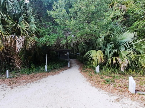
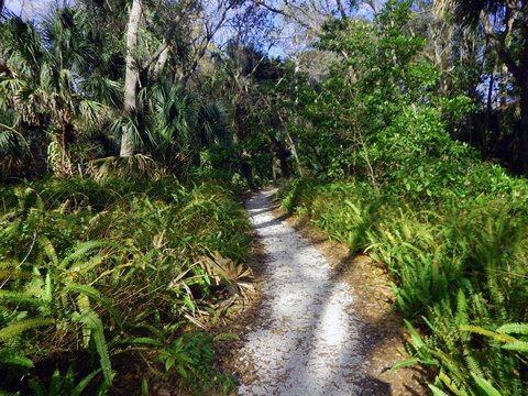
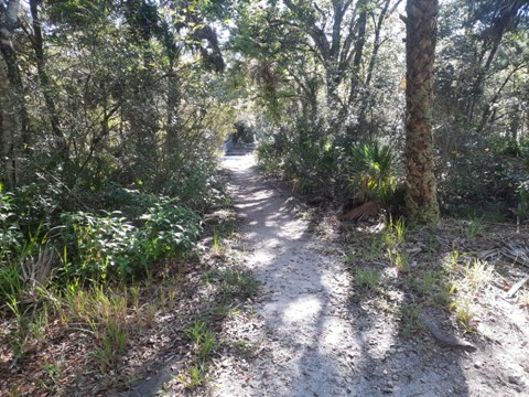
Oak Hammock
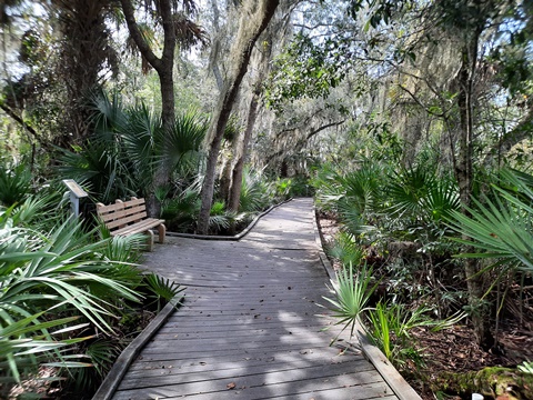
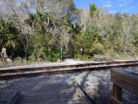
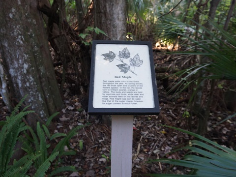
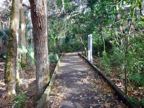
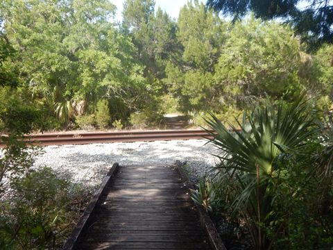
3/4 mile round-trip, figure-8 (double) loop. From the kiosk, it's about 1/10 mile to the loop, crossing the NASA Railroad track then a service road about halfway. We hiked both loops, encountering a few damp spots but many boardwalks make it very do-able. Benches and interpretative signs.
To the loops
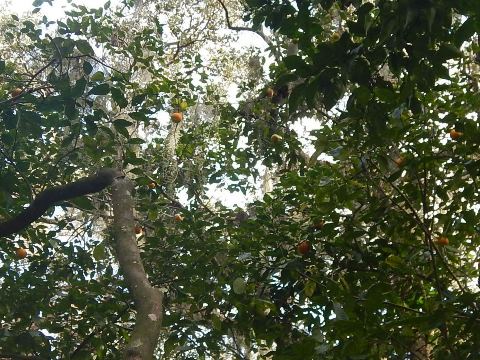
Some history: Look up in the trees in a few sections and you'll see oranges. These are descendants of the sour oranges originally introduced by the Spaniards in St. Augustine in 1565 and brought to Merritt Island by Douglas Dummitt who established groves here in the early 1800's.
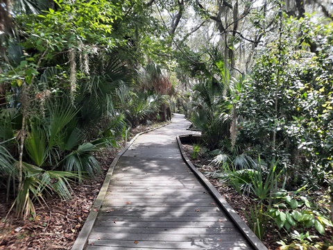
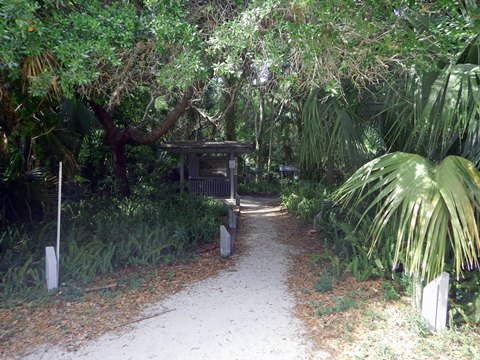
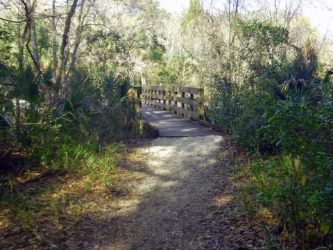
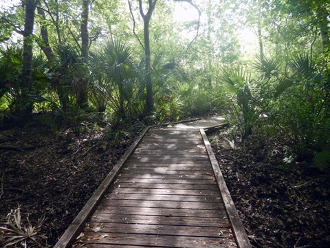
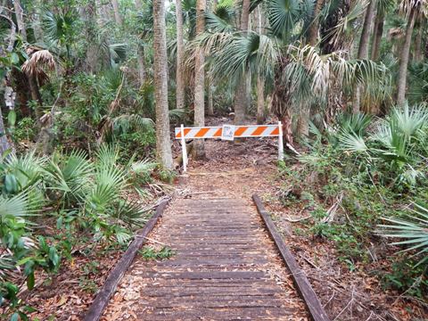
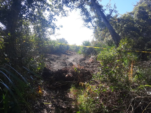
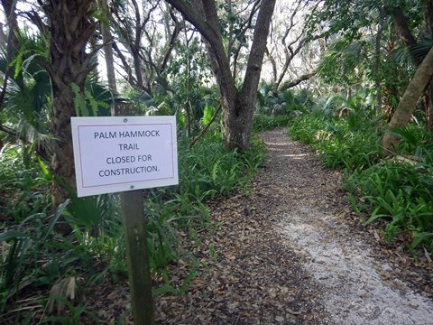
Palm Hammock*
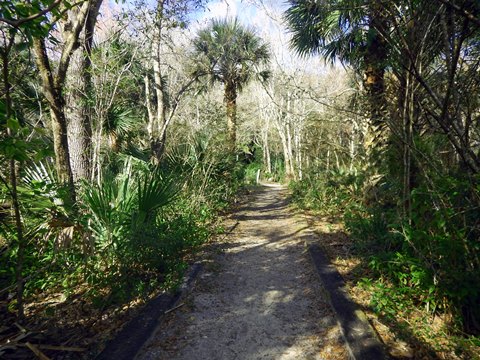
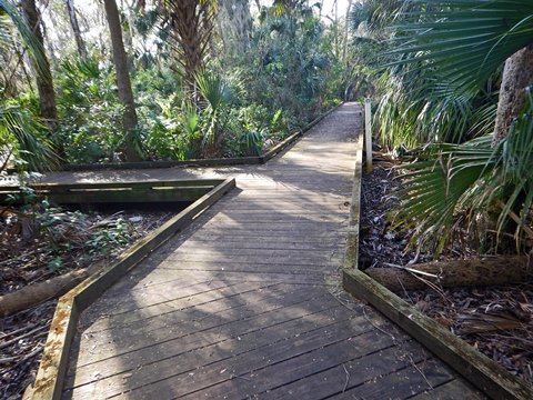
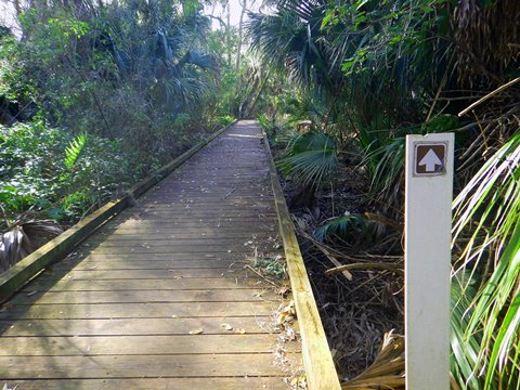
2 miles round-trip with a loop at the end. From the kiosk, the path runs about 1/10 mile to the railroad track, including boardwalks. Cross the track, then a parallel service road, and continue into the hammock on another boardwalk ("no bikes" sign). We found the next half mile to the loop to be scenic and peaceful, an easy hike with boardwalks, just a few sandy spots and some roots to watch for. Directional arrows help keep to the trail.
Note: At this writing, Palm Hammock Trail is closed while improvements are made. These photos and description are from earlier visits.

Connector - Palm Hammock to Oak Hammock
A portion of the service road is open to visitors to connect to the Oak Hammock Trail, about 1/10 mile. Beyond the entry points to the trails, "Area Closed to Public Entry" signs are posted.
*Note: These photos do not include the loop. We've visited several times, and one day hope to actually complete this trail!
1st visit: Too muddy
2nd visit: Closed at loop
3rd visit: Blocked by construction
4th visit: Shut at the entry
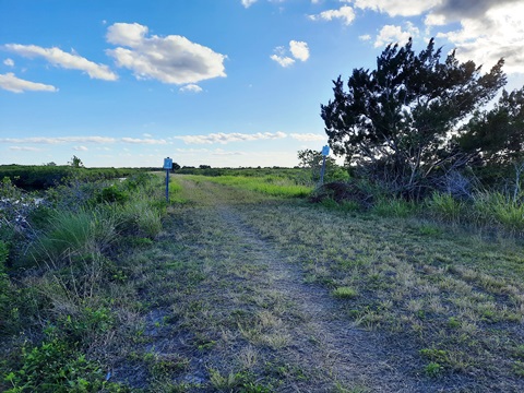
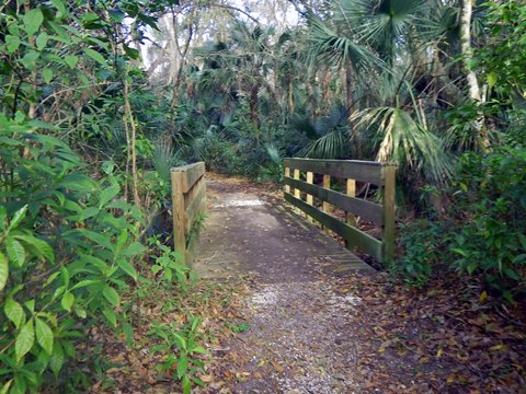
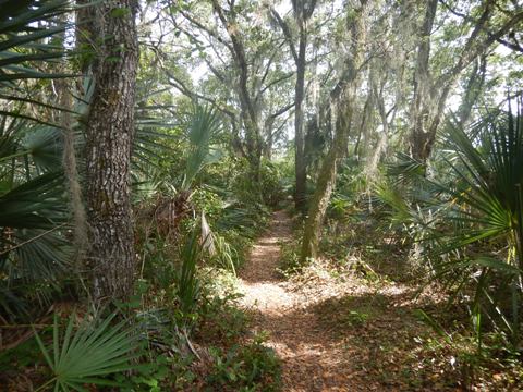
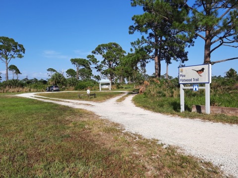
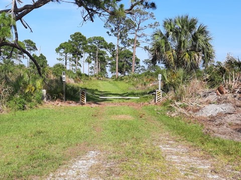
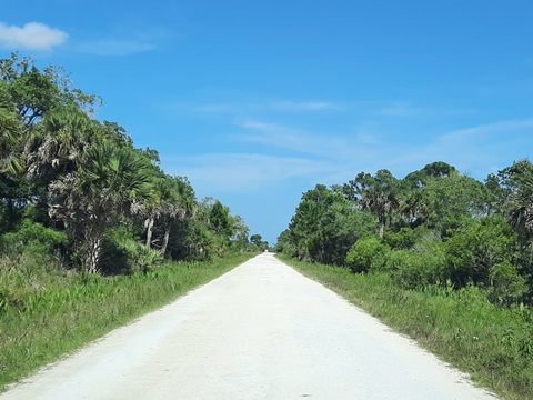
Pine Flatwood Trail
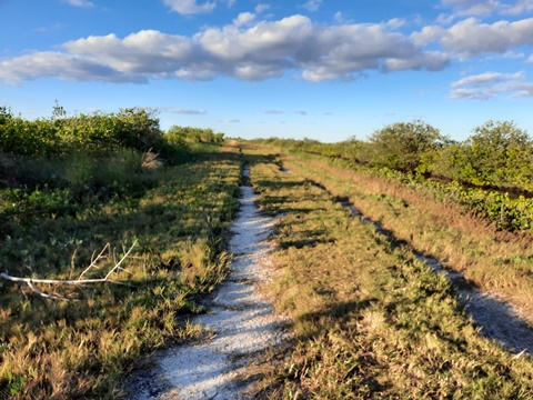
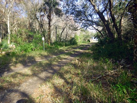
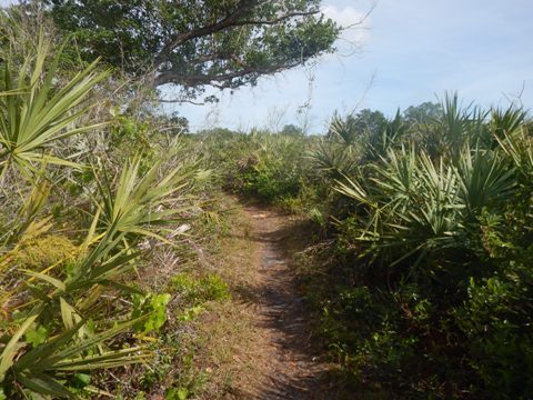
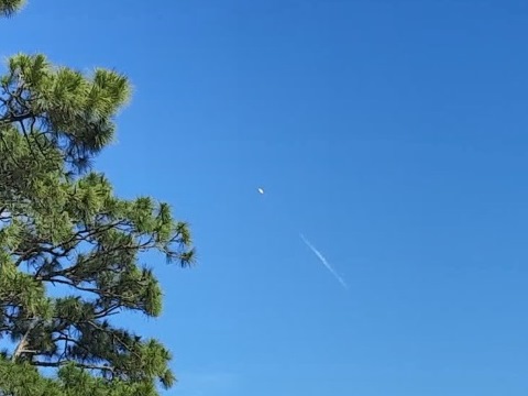
Located along SR 3, about 3 miles north of Haulover Canal. The trailhead has parking and information kiosk, no other facilities. The trail runs on fire roads, an easy hike on sand, dirt and grass. We hiked the loop in a counter-clockwise direction, watch for the directional arrows to stay on the trail. We liked the east leg best - following a ridgeline, with wide views of the surroundings. Returning on the north and western legs, the trail was more sandy and not as elevated, so fewer views. One day, we saw a bright light on the horizon - a rocket launch from Cape Canaveral! This trail is good for birdwatchers fall-spring.
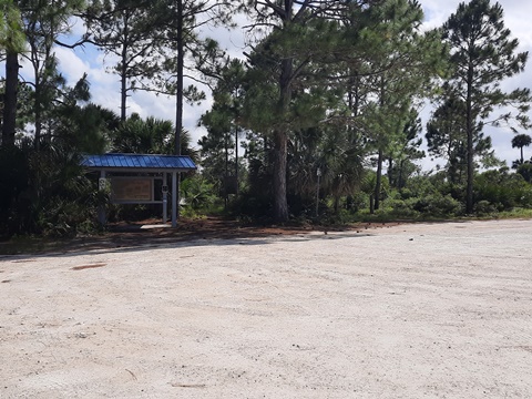
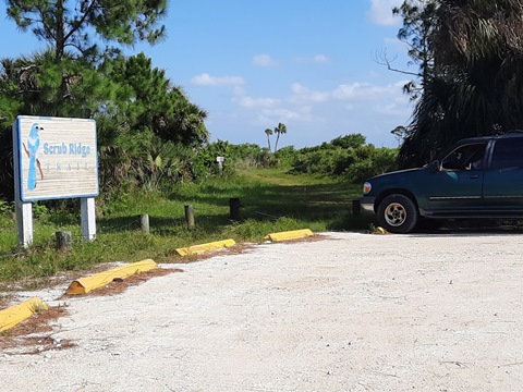
Scrub Ridge Trail
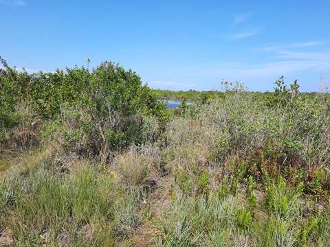
Located off SR 3, about 0.7 mile north from the end of Max Brewer Memorial Pkwy. The access road runs about 0.4 mile to the trailhead (parking, information kiosk, no other facilities). The trail is a 1-mile loop. From the parking area, we hiked it in a clockwise direction. On the eastern loop, it runs between a freshwater impoundment and scrub habitat. The western loop is through scrub. While not what we would call "scenic" (the Pine Flatwood Trail offers better views), it's an important wildlife habitat for the rare Florida scrub jay and other birds, plus indigo snakes and gopher tortoises.

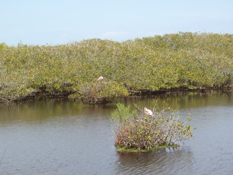
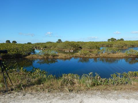
Wildlife
Wildlife Viewing
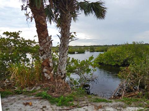
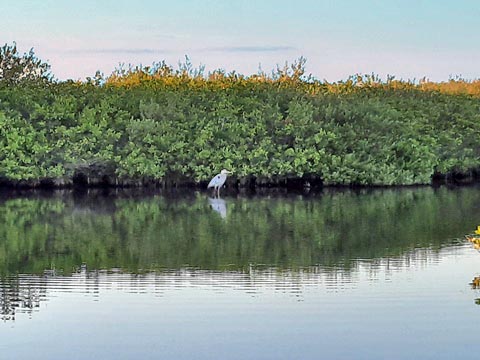
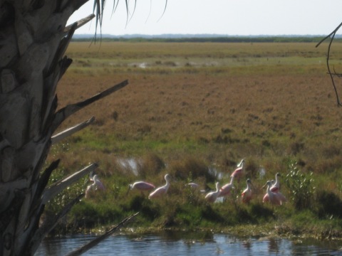
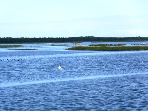
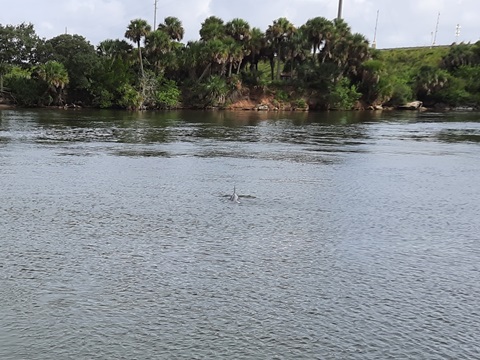
Here are some more we've seen off Wildlife Drive, Shiloh and Biolab Roads. Birdwatching is popular here, with 358 species identified - we've seen coots, osprey, white pelicans, herons, roseate spoonbill, songbirds, and more. On one visit, we chatted with a birdwatcher who told us she had counted 54 species so far that day. Other wildlife includes alligators, manatee, 140 species of freshwater and saltwater fish, bobcat, deer, and otter.
Manatee Viewing Area
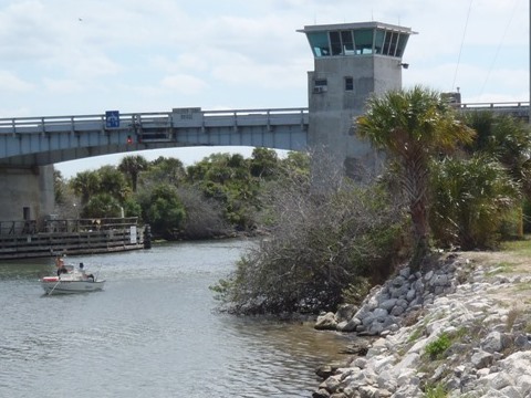
Along SR3, north of the Haulover Canal drawbridge and opposite the NW Haulover Canal access road, there's an entrance to the popular Manatee Viewing Area where manatee can be seen year-round. We've seen both manatee and dolphin from the viewing area. It's unknown exactly why manatee congregate here, but it's a popular spot in the winter. The canal was built in 1856 during the 3rd Seminole War, and is now (wider and deeper) part of the Intracoastal Waterway. Good views of the canal and the drawbridge. Parking, no other facilities.
More Information and Resources
Nearby Biking:
East Central Regional Rail Trail
Chain of Lakes Park
East FL Region - More trails
plus Regional Overview map
Nearby Paddling:
Merritt Island National Wildlife Refuge
Canaveral National
Seashore
Shipyard Island
Related Resources:
U.S. Fish & Wildlife Service - Merritt Island National Wildlife Refuge
Find Trails by FL Region or Listed A - Z

100FloridaTrails.com... 100+ Florida Multi-use Bike Trails, Best for Safe, Fun Recreation and Fitness
Other Websites:
BikeOrlando.net
PaddleFlorida.net
BikeTripper.net
Copyright © 100FloridaTrails.com. All Rights Reserved.