100 Florida Trails®
Top FL Multi-use Bike Trails
Map Links & Photos Galore
Coast-to-Coast Updates
You are here >
Home >
Top Ten >
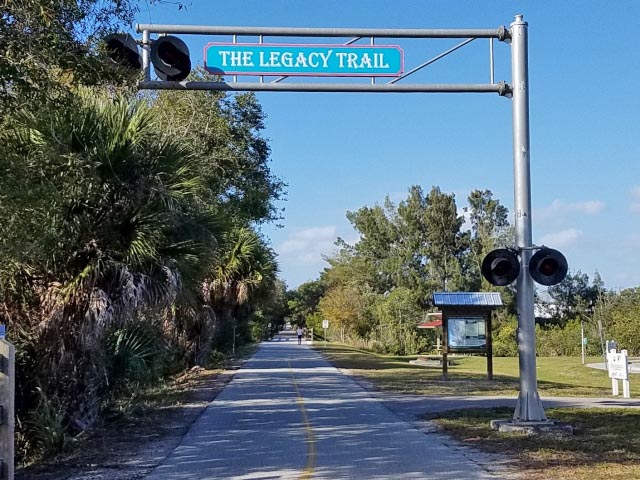
Legacy Trail
Latest update: March 2026
Legacy Trail... Bike Venice to Sarasota
A Top 10 Florida Bike Trail... E-Z Google Map, Photos Galore
The Legacy Trail runs along an old Seaboard Railroad corridor between Venice and Sarasota. Beginning at the Historic Venice Train Depot, the first third of the way to Oscar Scherer State Park is the most scenic and diverse. Now extended to downtown Sarasota, the trail totals 18.5 miles. Well maintained and almost entirely straight, this is a popular trail enjoyed by recreational and road bikers, walkers, joggers and inline skaters. With links to the Venetian Waterway Park Trail (9 miles) and North Port Connector (14 miles), this is evolving into a regional trail system now totaling more than 40 miles of biking. (Map link and photos below.)
Location: Sarasota County
End Points: Venice Avenue in Venice to
Fruitville Road (SR 780) in Sarasota
Mileage: 18.5 miles. Links to the Venetian
Waterway Park Trail (9 miles) and North Port Connector (14 miles)
Surface: Asphalt, 12 feet
Trailheads: Many (see map)
Nearby points of interest: Historic Venice
Train Depot, Oscar Scherer State Park, Circus Museums at
Ringling Museum (Sarasota)
Bike Shops/Rentals:
Bicycles International
(rentals, sales, service)
Real Bikes
(rentals, sales, service)
Venice Bikes and Trikes (mobile
rentals, repair)
See more here
Page Summary:
- Biking the Legacy Trail
- Venice Train Depot to Oscar Scherer State Park
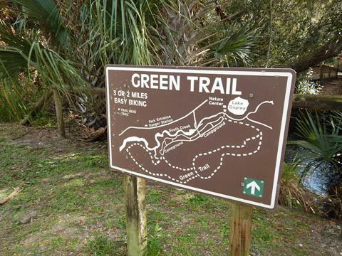
- Historic Venice Trail Depot, Legacy Park, Nokomis Park Trailhead, Nokomis Riverside Park, South Creek, Oscar Scherer State Park - Oscar Scherer State Park to Culverhouse Nature Park
- Osprey Junction, McIntosh Trailhead, Culverhouse Nature Park - Culverhouse Nature Park to Fruitville Road
- Ashton Road Trailhead, Sarasota Springs Trailhead, Pompano Road Trailhead
- Beneva Spur, Payne Park, Alderman Multi-Use Recreational Trail - More Information and Resources
Biking the Legacy Trail... Comments and Photos
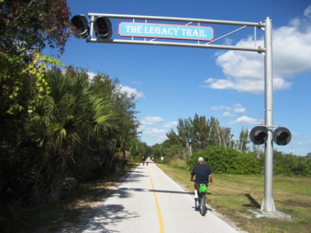
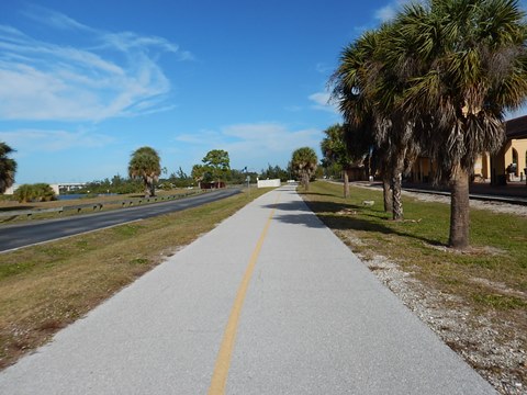
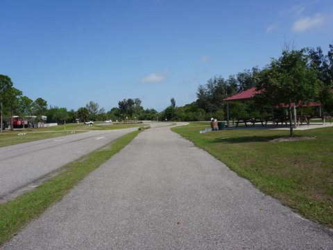
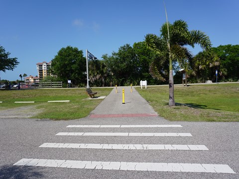
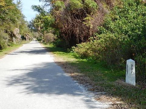
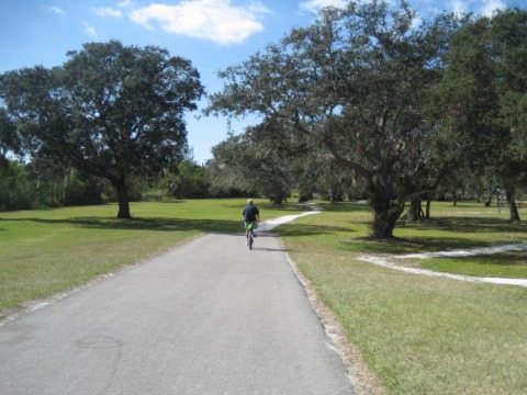
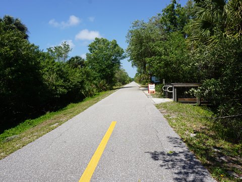
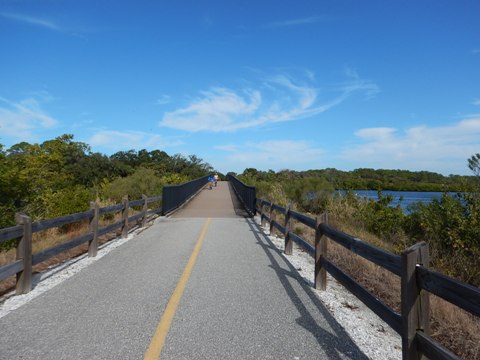
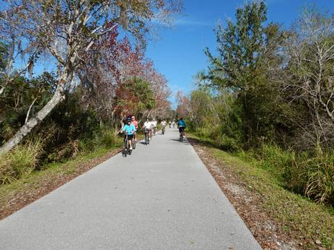
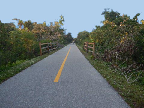
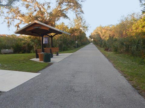
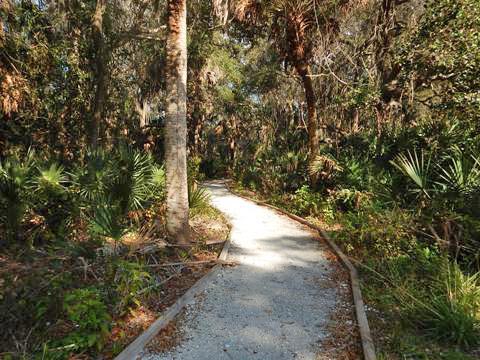
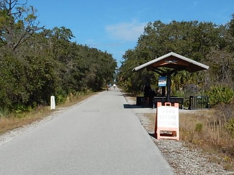
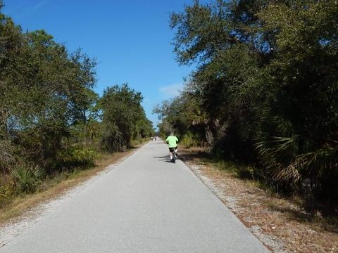
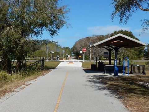
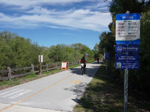
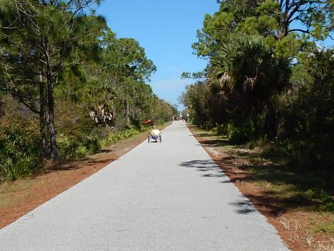
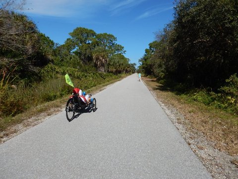
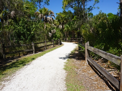
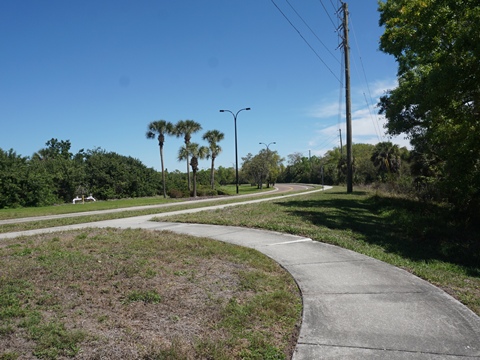
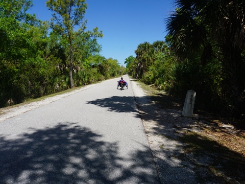
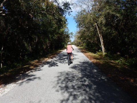
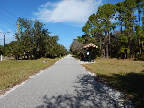
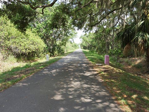
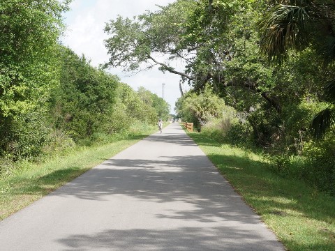
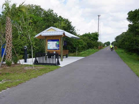
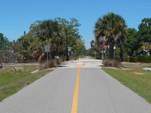
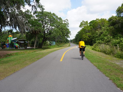
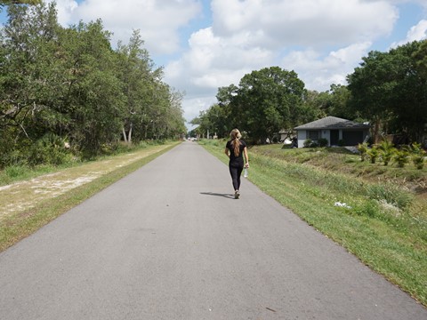
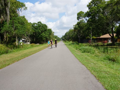
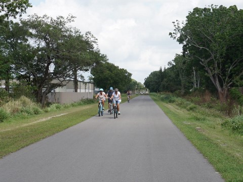
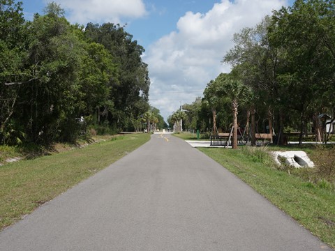
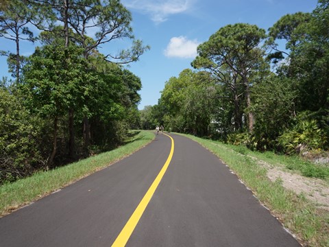
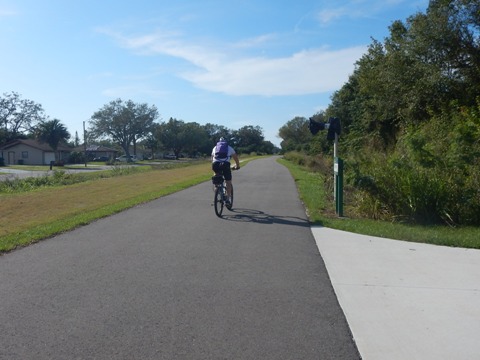
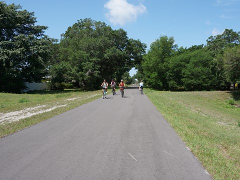
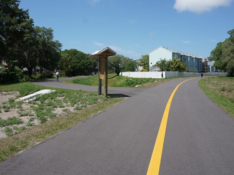
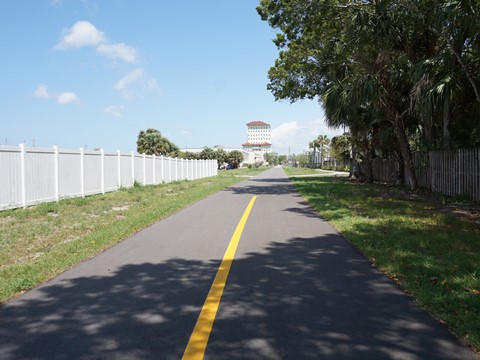
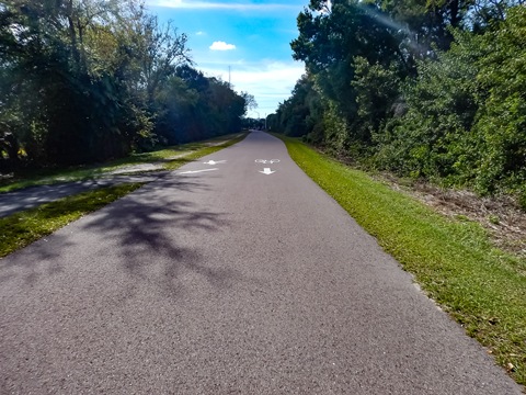
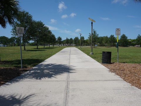
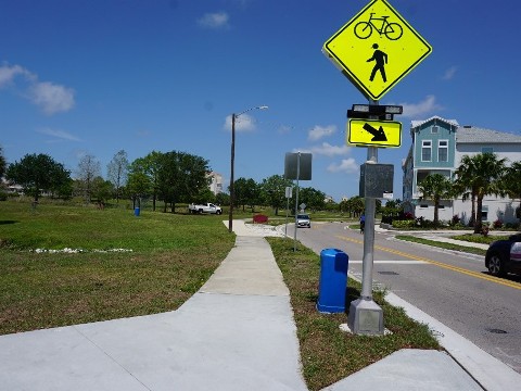
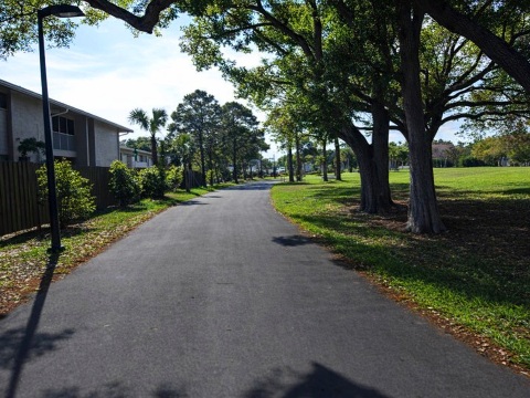
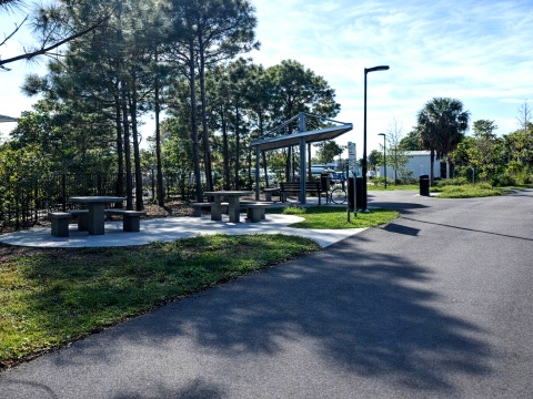
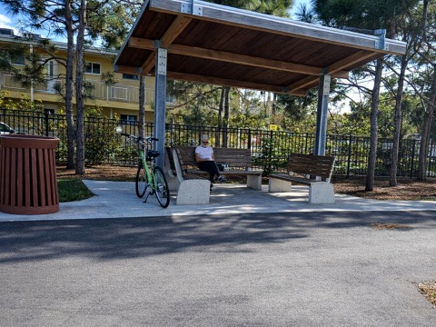
The smooth paved surface is easy to ride the entire way. Popular with road bikers, and now e-bikers, the trail has a posted 15 MPH speed limit. Excellent signage along the trail provides both directions and information on local history. Yellow emergency markers are embedded into the trail every 0.10 miles giving your location. Covered rest stations and benches are located every mile or so. Restrooms and water are at most trailheads. Local parks offer full facilities, playgrounds, and picnic areas. Old railroad mile markers are quaint reminders of the Legacy Trail's past (the number displayed on markers is the distance to Richmond, VA). Wildlife that may be seen along the way include gopher tortoises, snakes, lizards, rabbits, and assorted birds including the endangered scrub jay.
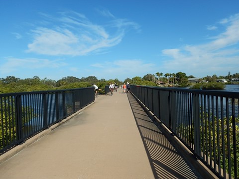
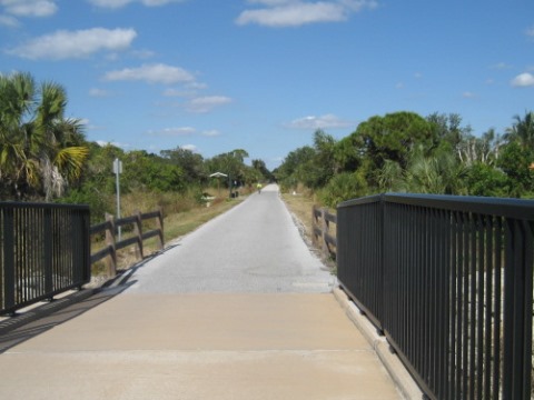
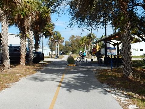
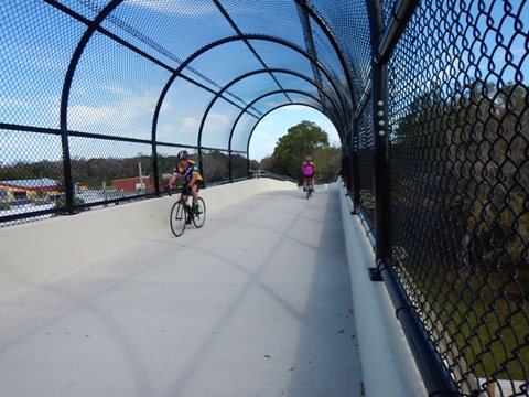
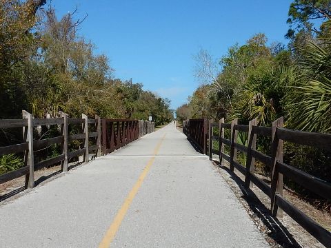
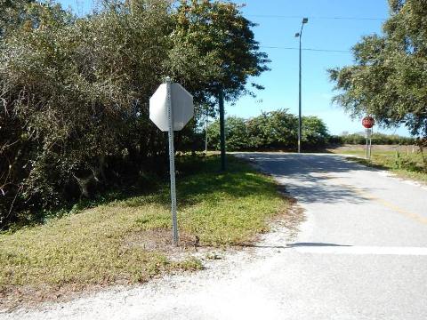
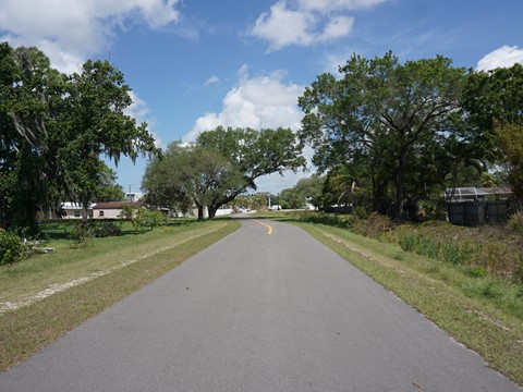
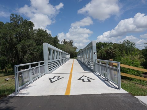
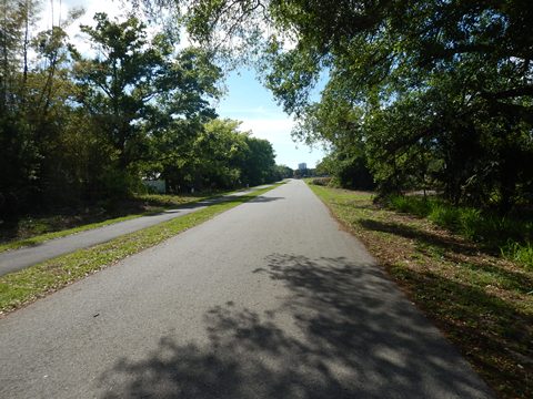
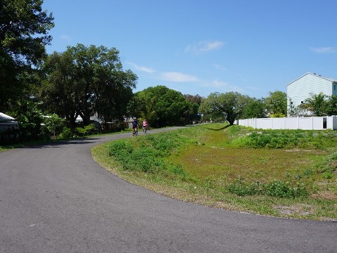
Here we visit the trail from south to north. The southern section of the trail is more tree-lined, providing nicely shaded sections, shelter from the wind, and a mostly quiet, rural feel. Causeways over small bays offer pleasant water views, and trail bridges over major roads (at US 41 and Laurel Road) are a bonus. The northern section includes more residential and commercial sections, less shaded and with more road crossings. Here, the trail bridges at Clark Rd. and Bee Ridge Rd. are welcome additions.
Venice Train Depot to Oscar Scherer State Park (about 5.4 miles)
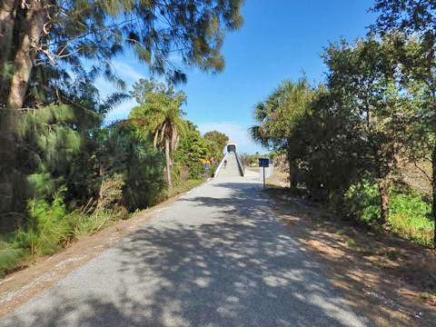
Heading north, we believe most people will find the first third of the Legacy Trail to be the most interesting section. It is certainly the most diverse. Here, riders cross three waterways and two major trail bridges, before reaching the surrounds of Oscar Scherer State Park. There are just three road crossings, and trail bridges take riders over the most hazardous.
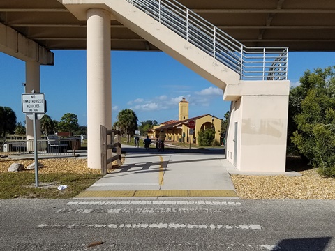
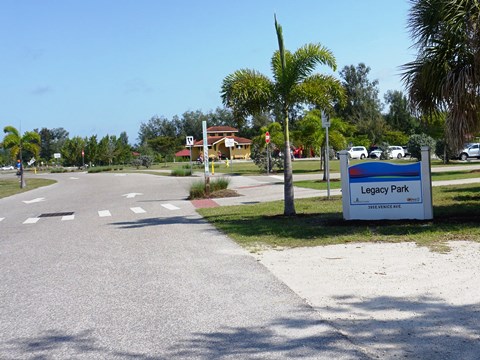
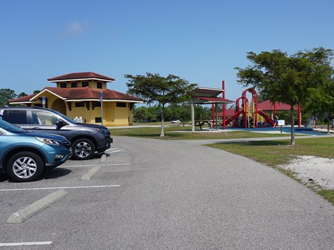
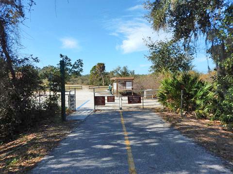
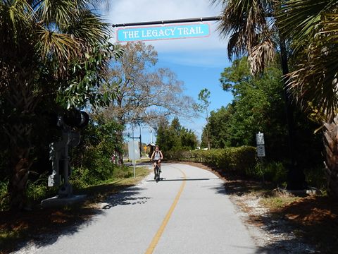
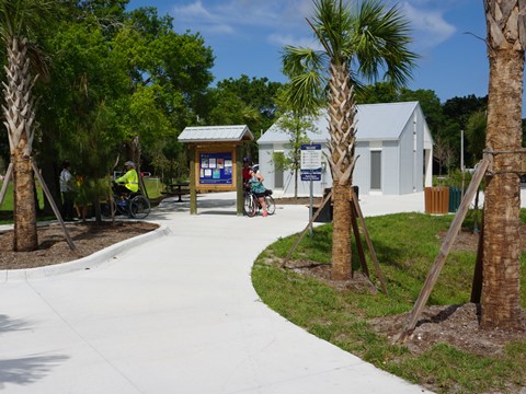
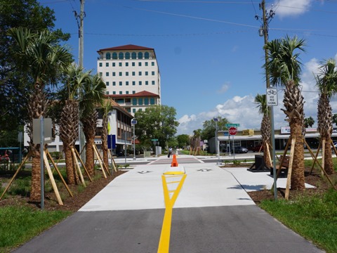
Begin Trail, Legacy Park Trailhead
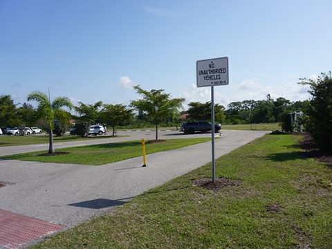
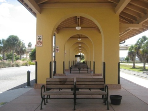
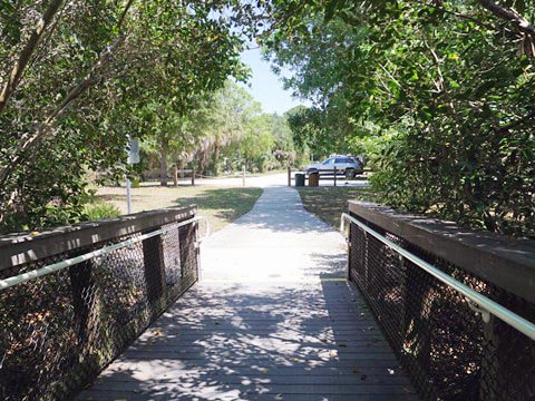
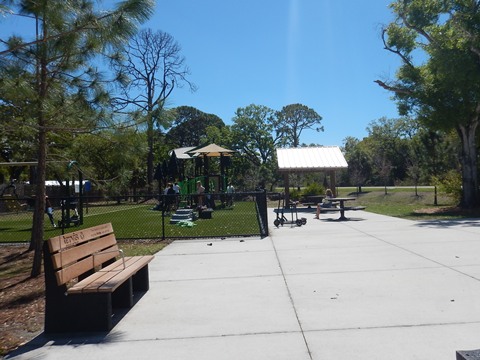
The Legacy Trail starts at E. Venice Ave. under the Venice Ave. Bridge, at its convergence with Venetian Waterway Park (link below), a linear park running on both sides of the Intracoastal Waterway. It then runs past the Historic Venice Train Depot. Parking for both the Legacy Trail and Venetian Waterway Park is at Legacy Park behind the depot. A path runs around the park past parking, restrooms, picnic pavilions, playground, kayak/canoe launch), then links to the Legacy Trail.
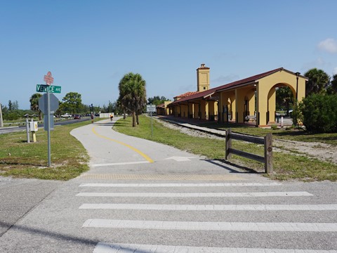
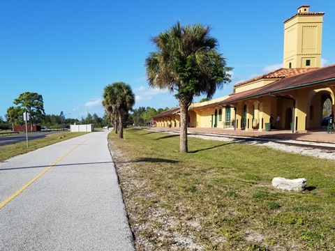
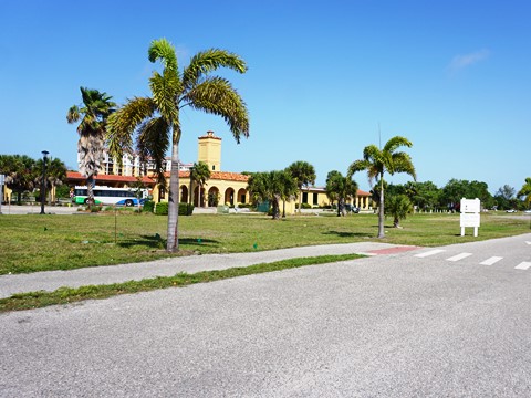
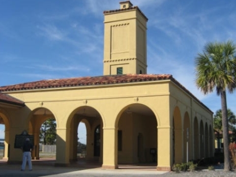
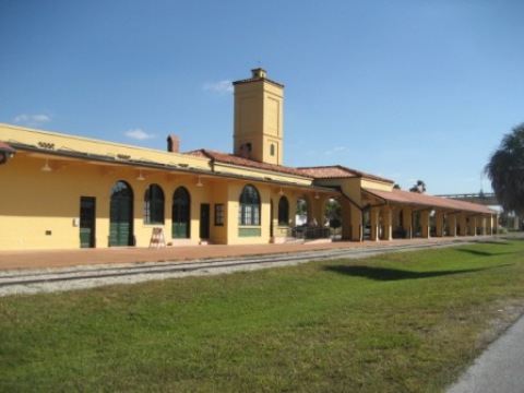
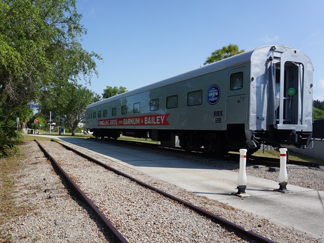
Historic Venice Train Depot
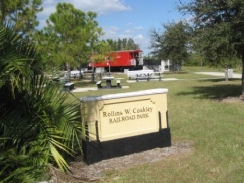
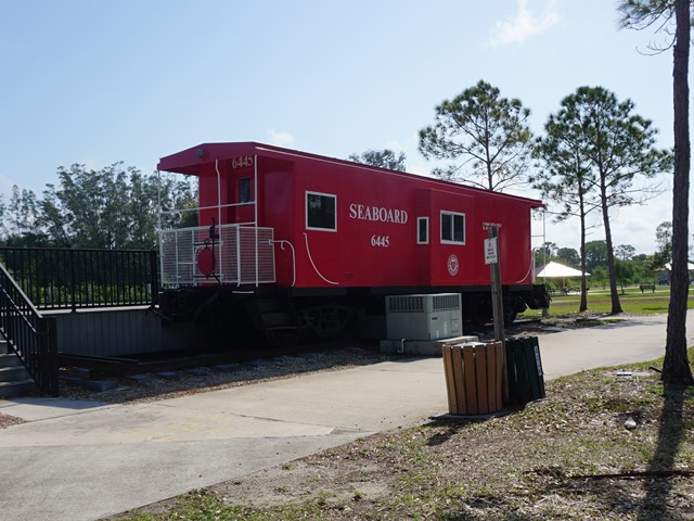
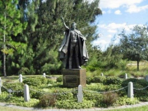
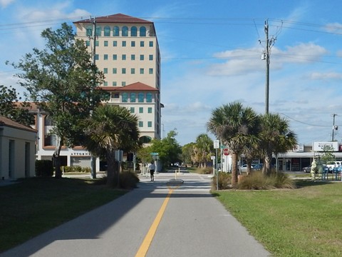
The Venice Seaboard Air Line Railway Depot was built in 1927, with passenger rail service ending in 1971. Restored in 2003, the station boarding area now serves as a bus depot. Listed on the National Register of Historic Places, tours are available. On the north side of the depot at Rollins W. Coakley Railroad Park, check out the restored caboose and Ringling Bros. and Barnum & Bailey Circus train car. There's also a statue of circus performer and Venice resident Guenther Gebel-Williams, the "Greatest Wild Animal Trainer of All Time."
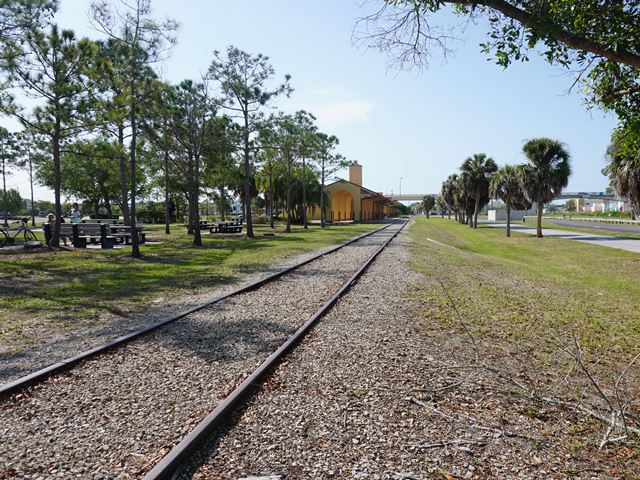
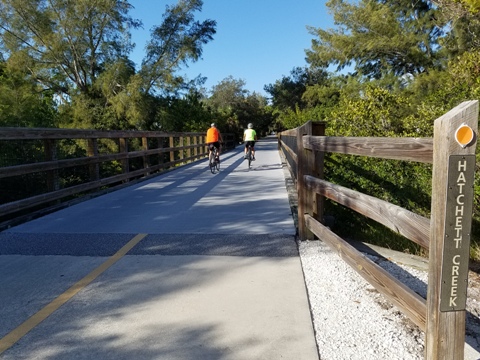
Train Depot to Nokomis Park Trailhead
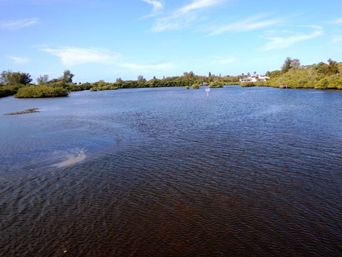
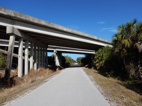
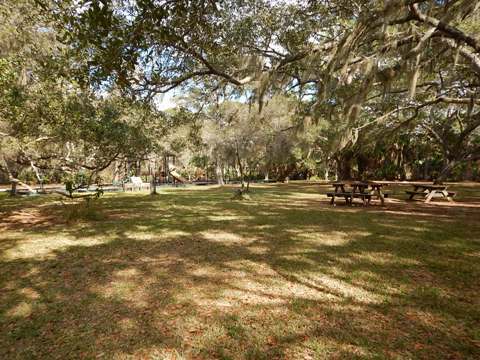
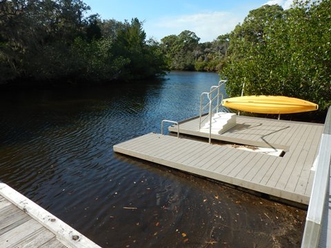
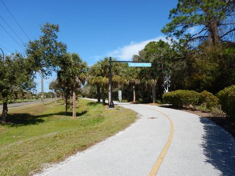
Leaving the trailhead, this section starts through a shaded corridor, first crossing Hatchett Creek then continuing to the bridge over the US 41 Bypass - a huge benefit at this very busy road. The trail passes Patriot Park Trailhead (dedicated to victims of 9-11, parking, restrooms, picnic), then a scenic causeway spans Roberts Bay. Just over the causeway along Roberts Bay is the Nakomis Community Park Trailhead (parking, restrooms, picnic, playground, playing fields, fishing pier, kayak/canoe launch).
Nokomis Park Trailhead to Laurel Road Bridge
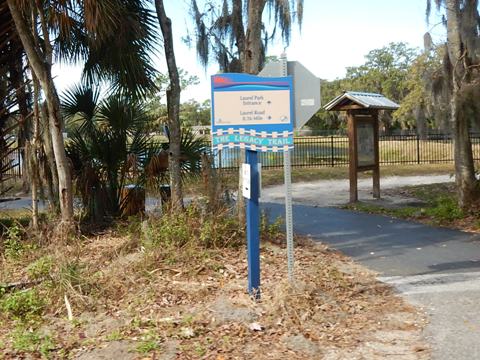
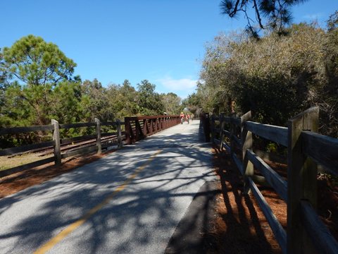
From Nakomis Park Trailhead northbound, the trail crosses Colonia Drive to Nokomis Riverview Park (parking, kayak/canoe launch), located across a short bridge over a canal on Florence Rd. This marks the beginning of the North Port Connector (see details at the link below). Continuing on the Legacy Trail, another causeway spans Dona Bay. The Laurel Park Trailhead (parking, restrooms, picnic, playground, playing fields, surrey rides), is along this section. We found the trail bridge over Laurel Road it to be a little steeper than most, but no complaints - it's a big asset!
Laurel Road Bridge to Oscar Scherer State Park
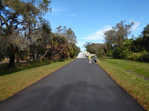
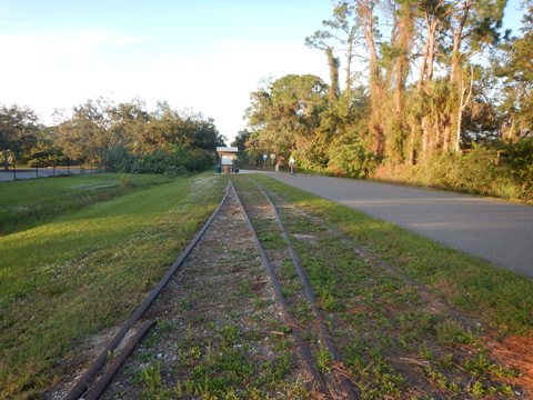
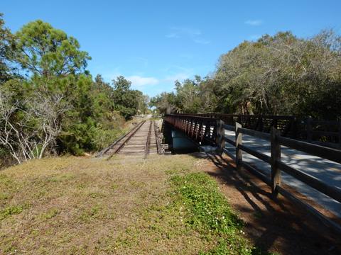
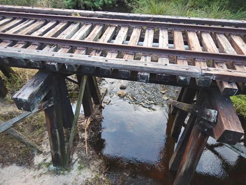
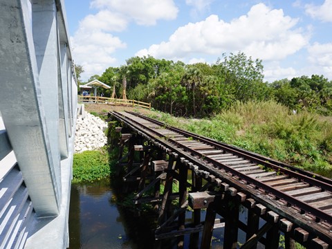
Just over the bridge are a section of old track that has been preserved, and a rest station. In about two miles, past the SR 681 underpass, Oscar Scherer State Park begins. Crossing South Creek are a trail bridge and an old trestle bridge - a remaining section of the original 1911 trestle. Just over the bridge is an entrance to the State Park, with parking, picnic area, and many off-road trails (mostly hard-packed, but plenty of soft sand patches) - pay entrance fee at the pay station.
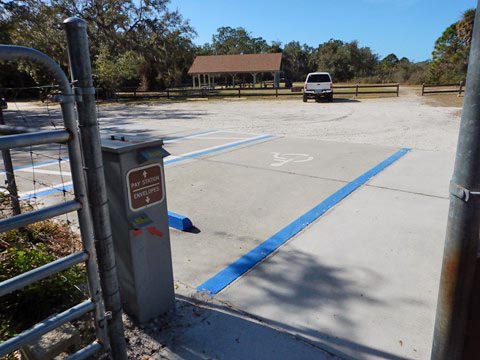
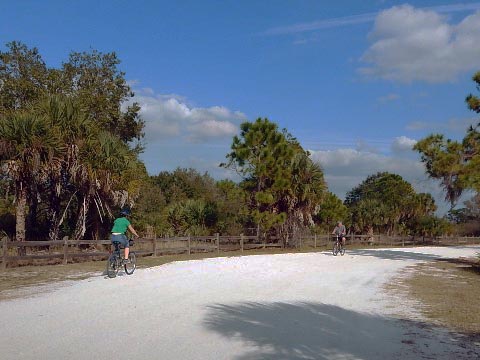
Oscar Scherer State Park
The 1,400 acre State Park has parking, restrooms, camping, picnicking, hiking, fishing, playground, and kayaking on South Creek. There are about 15 miles of marked hiking and biking trails (best for fat-tire bikes). The park is an important habitat for the endangered Florida Scrub Jay.
Also visit us here: Kayaking at Oscar Scherer State Park
Oscar Scherer State Park to Culverhouse Nature Park (about 5.1 Miles)
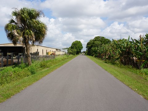
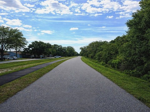
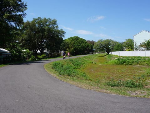
Beyond the State Park entrance, the Legacy Trail continues for about 1.5 miles before leaving the Park. There are no notable natural features beyond this point. The trail continues through the massive Palmer Ranch subdivision. Yet even here, there's a 50' natural buffer on both sides until merging parallel to McIntosh Road. There are only a couple of residential road crossings, and typically fewer people on the trail here, so road bikers may have an opportunity to pick up the pace (keeping in mind the 15 mph speed limit).
State Park to Osprey Junction Trailhead
This section runs through the State Park with mixed habitats including pine flatwoods, oak hammocks, scrub, and marsh. Mostly unshaded, with no road crossings and no facilities.
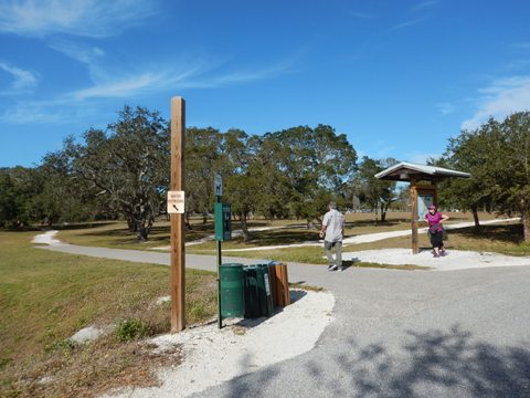
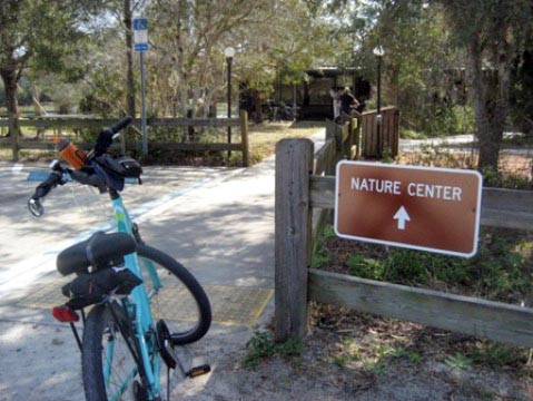
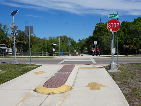
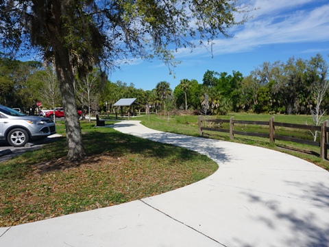
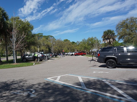
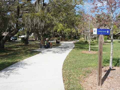
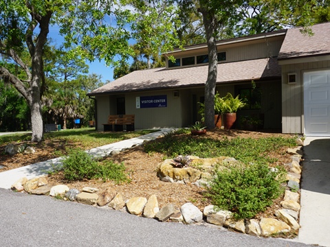
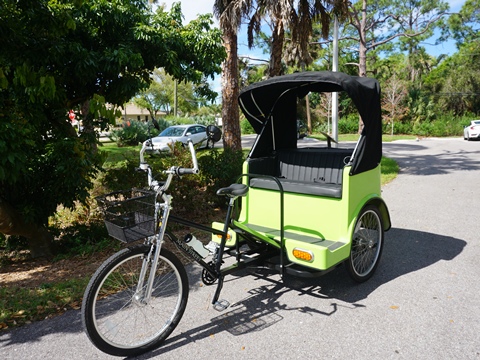
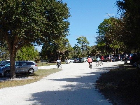
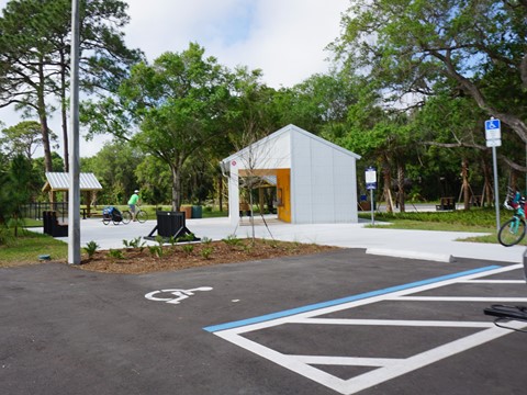
After crossing Bay Street is the Osprey Junction Trailhead with parking, restrooms, benches, picnic. Paved paths wind around the park with its many gardens. The Visitor Center, staffed by Friends of Osprey Junction Trailhead volunteers, is open on Thursdays, with restrooms, information, and pedicab rides available.

Osprey Junction Trailhead to McIntosh Road Trailhead
This section runs through the Palmer Ranch development, with the wide, mostly tree-lined buffer masking the surroundings. Another road crossing is at Central Sarasota Pkwy.
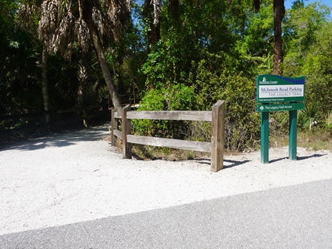
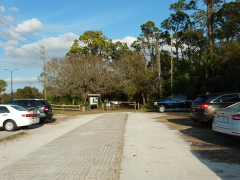
Just past the Palmer Ranch Station, a 2/10 mile path leads to the McIntosh Road Trailhead (parking only). An accessible path runs on the sidewalk along McIntosh Road for 1/4 mile to the trail access point. As the trail may seasonally flood, this also serves as an alternate bike route from the trailhead to the trail (see map).
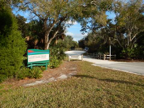
McIntosh Road Trailhead to Culverhouse Nature Park
Though surrounded by subdivisions, the wide buffer masks the surroundings as the trail continues. The road crossing at Palmer Ranch Road can be busy, be careful and use the crossing signal.
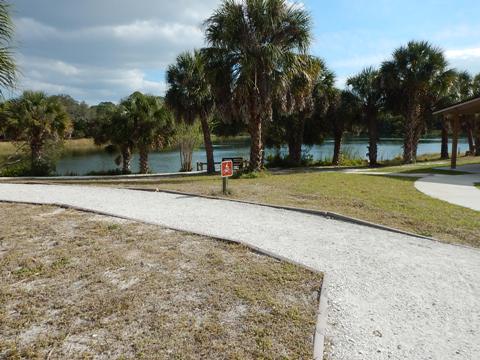
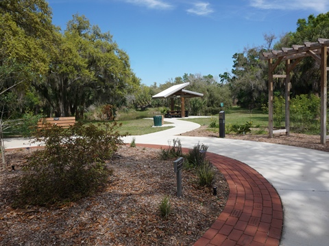
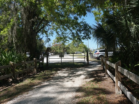
At Culverhouse Nature Park are parking, restrooms, picnic area, nature trails, community garden.
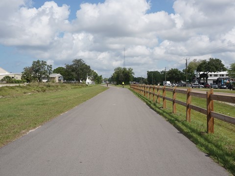
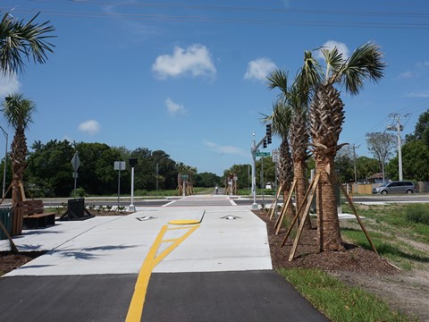
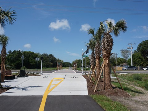
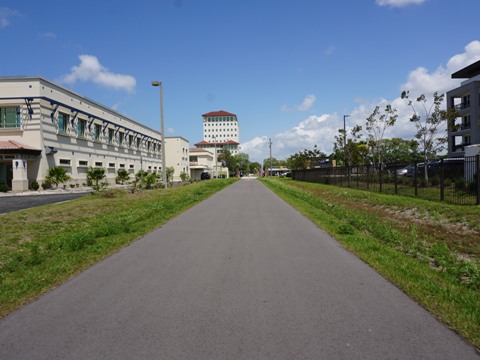
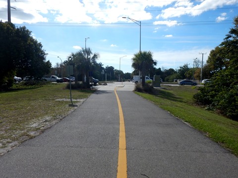
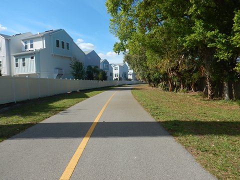
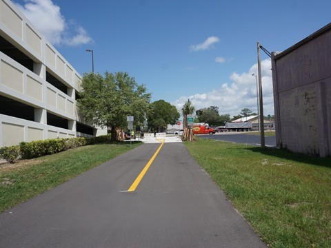
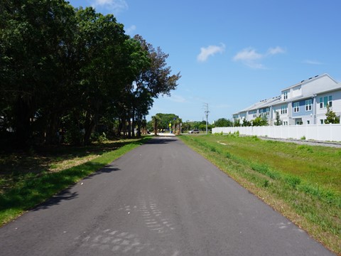
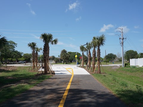
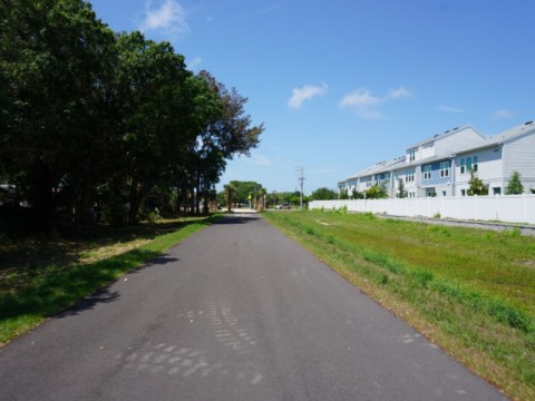
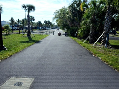
Culverhouse Nature Park to Fruitville Road (about 8 Miles)
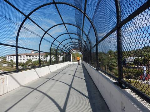
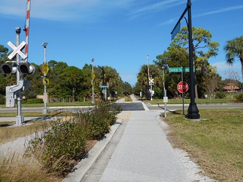
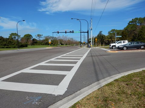
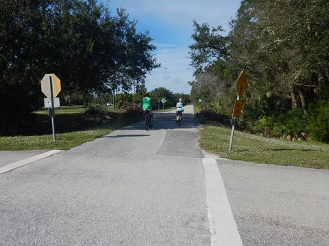
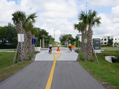
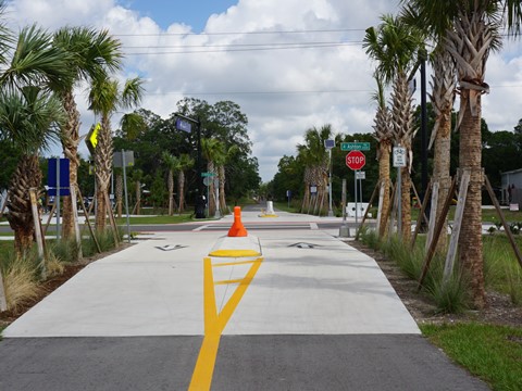
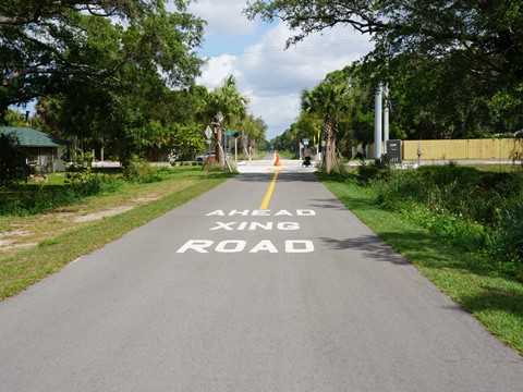
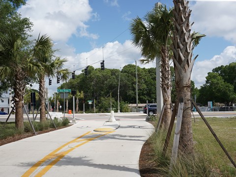
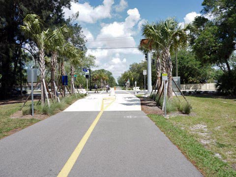
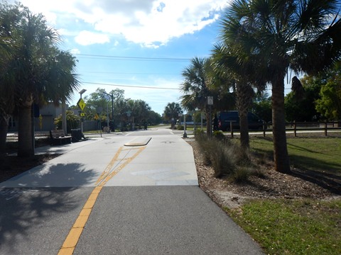
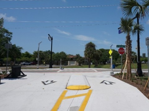
The newest section of trail, this section provides connectivity to downtown Sarasota, with neighborhood access to homes and schools. This is a popular section, we saw both road bikers and locals. The trail ends in downtown Sarasota at Fruitville Road. There are four trailheads, with covered rest stations and benches regularly along the way. This is a more developed area relative to the rest of the trail and passes some industrial sites visible from the trail. There's a wide buffer, but little shade and more road crossings (13). The road crossings have enhanced signage with crossing signals or flashing lights that can be activated. Overpasses at busy Clark and Bee Ridge Roads are bonuses.
Culverhouse Nature Park to Ashton Trailhead
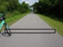
The first section leaving Culverhouse Nature Park has a protected buffer. We were pleased here to visit our foot of trail, part of a Friends of the Legacy Trail fundraising effort (see below). From Sawyer Loop Road to Clark Road to Ashton Road is more industrial, with less vegetation along the buffer to mask the surroundings. The road crossings are busy, take care, and the new trail bridge at Clark Rd. is a positive addition.
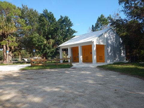
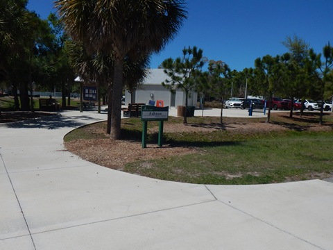
Ashton Trailhead includes parking, restrooms, picnic, playground, and event field.
Ashton Trailhead to Sarasota Springs Trailhead
This section is more residential, with the wide buffer mostly masking the surroundings except for one business area. This section includes four road crossings, with a new overpass now at Bee Ridge Rd. We were taken with the ingenuity of one homeowner along the trail, with the "drawbridge" over the ditch.
Sarasota Springs Trailhead features parking, restrooms, picnic, and playground.

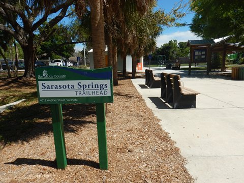
Sarasota Springs Trailhead to Beneva Rd.
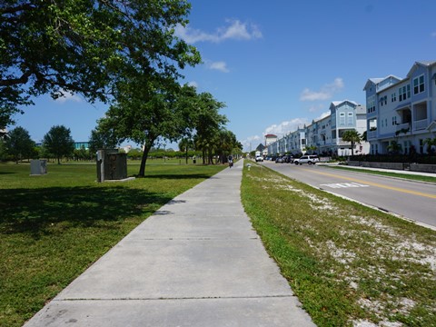
Immediately past the Sarasota Springs Trailhead is busy Webber St. This section includes 6 road crossings. Here, the trail runs through a mostly residential area until nearing downtown Sarasota. The buffer is mostly open to the surroundings. A nice feature when crossing two creeks is the old trestles remaining next to the trail bridges. At Beneva Rd. is a spur running north to Fruitville Rd. and the Circus Rd. Trail (see below).
Beneva Rd. to Pompano Trailhead
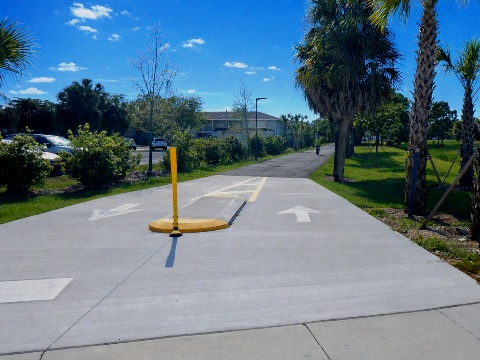
Past Beneva Rd. is another old trestle bridge, then the Bifurcated Trail begins. This is a 6-foot pedestrian pathway parallel to the Legacy Trail, extending about 1.4 miles to Shade Ave. with future extension planned.
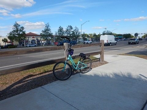
The Bifurcated Trail aims to enhance pedestrian and cyclist safety. With growing trail use, and more e-bikes, this kind of addition will be even more needed. On our latest trip, we observed mostly e-bikes on the trail (some clearly exceeding the 15 mph speed limit).
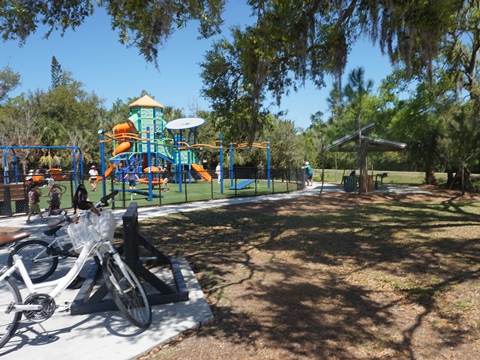
The Pompano Trailhead has parking, restrooms, bike repair station, picnicking, playground, and pickleball courts.
Pompano Trailhead to Fruitville Road
From the Pompano Trailhead is mostly residential. The bifurcated trail ends shortly before the Tuttle Ave. road crossing, then resumes again and continues to Shade Rd. A kiosk marks the spur to Payne Park (see below) - bear right to continue on the Legacy Trail.
The trail runs past more residential development and some county facilities before crossing Ringling Blvd. Businesses are alongside the trail to its end at Fruitville Rd.

THIS SECTION HAS TWO SPURS
Beneva Rd. Spur
Where the Legacy Trail crosses Beneva Rd., a new path runs 1/2 mile north alongside Beneva Rd. to Fruitville Rd.
Across Fruitville Rd. is the Circus Trail and Circus Trail Nature Park. (On this trip, we chose not to cross busy, 6-lane Fruitville Rd., a bridge is needed here!)
Spur to S. School St.
Legacy Trail to S. School Ave.
The spur runs about 2/10 mile to S. School Ave. through a residential area (buffered). After crossing S. School Ave., it branches to Payne Park and to the Alderman Multi-Use Recreational Trail.
S. School Ave. to Payne Park
The spur runs about 1/10 mile along S.School Ave. to Payne Park (parking, restrooms, picnic, cafe, playground, and more). A shared-use path circles the park, once site of a pro baseball spring training park (1924-1989).


More Information and Resources
Nearby Biking:
Venetian Waterway Park
North Port Connector
Myakka River State Park (eco-biking)
West FL Region - More trails
plus Regional Overview map
Nearby Paddling:
South Creek at Oscar Scherer State Park
Myakka River State Park
Related Resources:
Sarasota County Government -
The Legacy Trail
Legacy Trail Surrey Program
A wonderful way for our elderly or mobility-challenged to enjoy the trail
Cycling
in Venice
Support and Advocacy:
Friends of
the Legacy Trail
Friends of
Oscar Scherer Park
Friends of Sarasota County Parks
Venice
Circus Arts Foundation
Saving the memory of the Venice Circus Arena
Support the Legacy Trail:
Ways to donate: (click for details)
- Legacy Trail Capital Campaign
- Legacy Trail General Fund
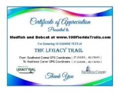
We were proud to sponsor the Legacy Trail Square Foot Campaign, funding specific square feet of the Legacy Trail. We visited "our" square feet of trail using the GPS coordinates shown on our Certificate of Appreciation.
Find Trails by FL Region or Listed A - Z

100FloridaTrails.com... 100+ Florida Multi-use Bike Trails, Best for Safe, Fun Recreation and Fitness
Other Websites:
BikeOrlando.net
PaddleFlorida.net
BikeTripper.net
Copyright © 100FloridaTrails.com. All Rights Reserved.