100 Florida Trails®
Top FL Multi-use Bike Trails
Map Links & Photos Galore
Coast-to-Coast Updates
You are here > Home >
Trails >
West Florida >
Courtney Campbell Trail
Latest update: December 2025
Courtney Campbell Trail... West Florida
9.5 Mile Causeway Trail Across Tampa Bay Between Clearwater and Tampa
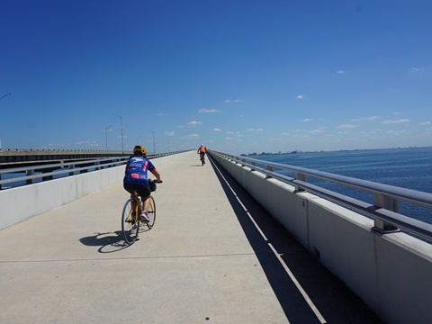
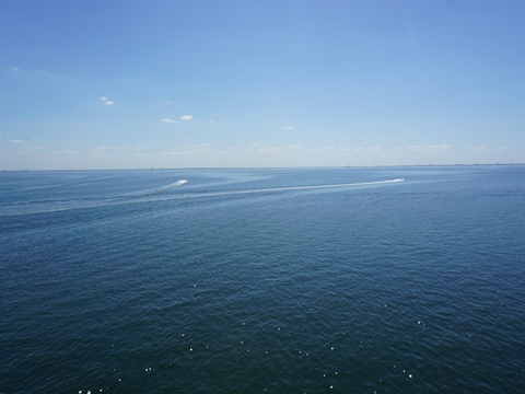
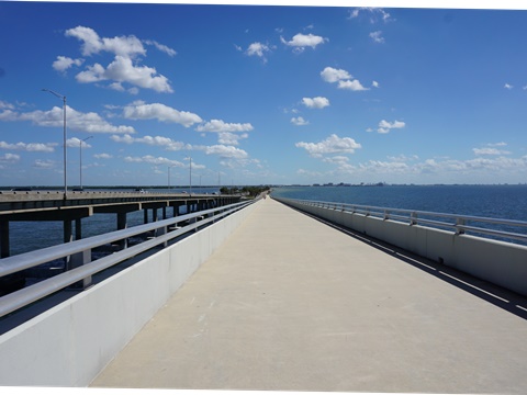
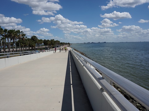
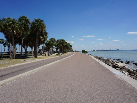
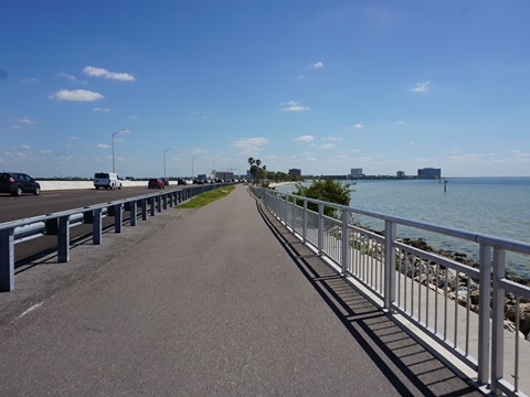
The Courtney Campbell Trail runs for 9.5 miles along the entire south side of the Courtney Campbell Causeway (Gulf-to-Bay Blvd., SR 60) across Old Tampa Bay. Featuring scenic water views, the trail is entirely off the road, with wide medians, barriers and including bike bridges that separate it from the roadway. The highlight is the 45-foot-high bridge near the midpoint - bring a camera for the spectacular Bay views. This is an extremely popular trail used by bikers, walkers, runners, hikers, and for bird and wildlife watching - a Florida "must-do." (Map link and photos below.)
Location: Pinellas (4 miles) and Hillsborough
(5.5 miles) Counties
End Points: Clearwater and Tampa
Mileage: 9.5 miles
Surface: Paved, 8-16 feet
Nearby points of interest: Safety Harbor, beaches, many in both
Clearwater and Tampa
Bike Shops / Rentals:
Chainwheel Drive
(Clearwater, Palm Harbor; rentals, sales, service)
Outspokin Bicycle
(Clearwater, Tampa; sales, service)
Page Summary:
- Biking the Courtney Campbell Trail - West to East
- Bayshore Trail to Courtney Campbell Trail
- Courtney Campbell Causeway Beach to Main Bridge
- The Main Bridge
- Main Bridge to Ben T. Davis Beach
- Ben T. Davis Beach to Veterans Highway - Some History
- More Information and Resources
Biking the Courtney Campbell Trail ... Comments and Photos
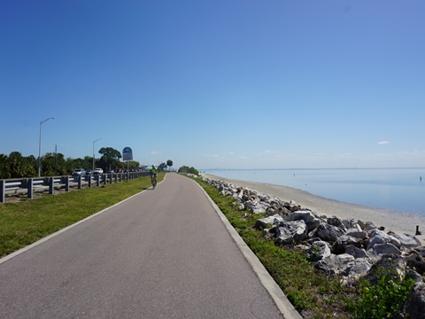
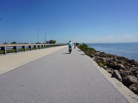
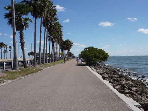
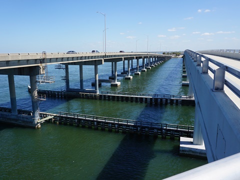
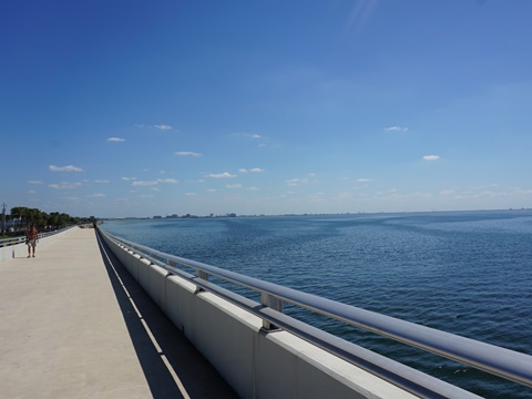
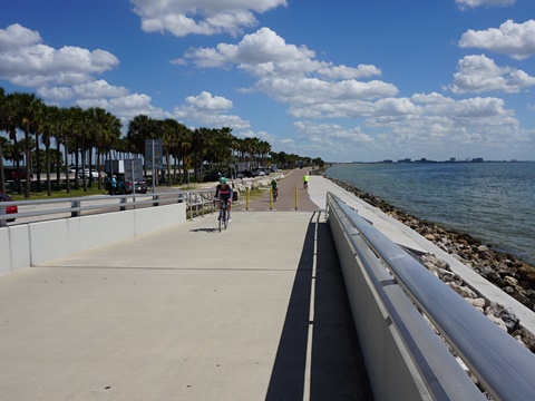
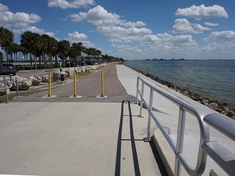
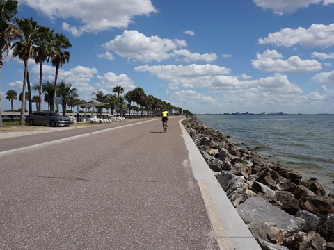
The Courtney Campbell Trail offers water views virtually the entire way. The trail is a smooth and scenic ride, almost totally straight and flat, with just one "hill" at the middle bridge. Going over open water, wind is a big factor, so plan accordingly. Parking along the causeway can be at a premium, especially on weekends. Free parking is available in the middle on both sides of the tall bridge, and there is paid parking at the beaches near both ends of the causeway. Connecting bike trails at the eastern and western ends provide additional parking options (see map). There are no water or restrooms except at Ben T. Davis Beach, and there's no shade, so bring sunscreen, water and snacks. An access road runs the length of the Causeway on the north side, popular for fishing - it runs under the road and provides trail connections at both ends of the middle bridge.
Tip: bike into the wind first, then relax and enjoy the endorphins pumping when returning with the wind at your back.
Here, we follow the trail West to East.
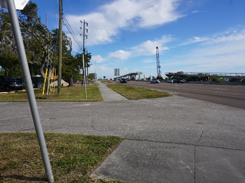
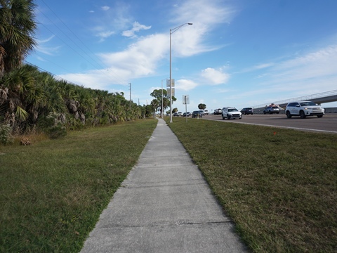
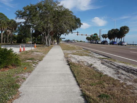
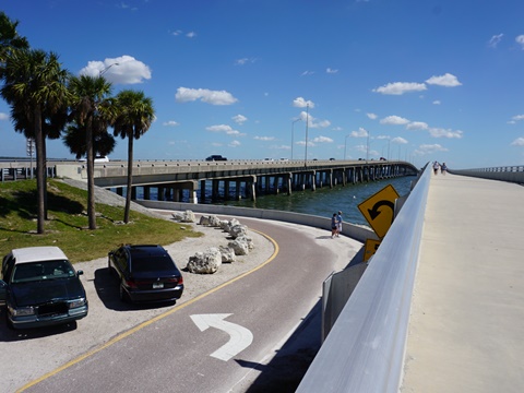
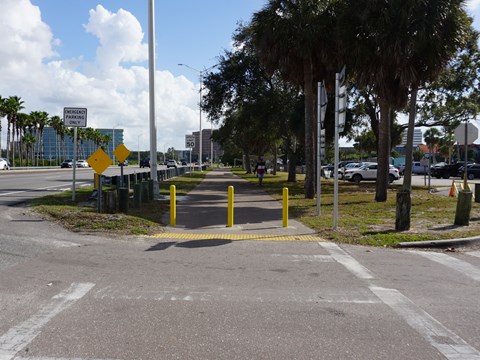
Bayshore Trail to Courtney Campbell Trail
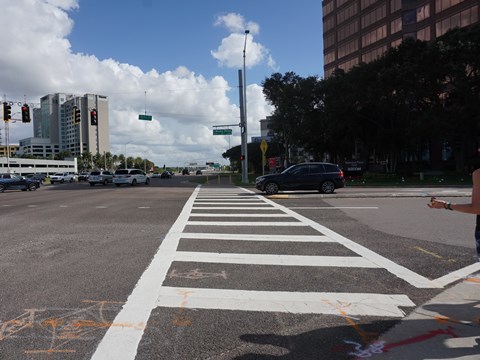
Construction of a biking/pedestrian bridge connecting the Bayshore Trail to the Courtney Campbell Trail is in progress, projected for completion in late 2026. The trail is temporarily closed at the Courtney Campbell Causeway Beach entrance, so a detour is in place. From the Bayshore Trail, ride east on the sidewalk along Gulf-to-Bay Blvd. (SR 60) to the entrance to Nova Southeastern University and cross SR 60 to the Courtney Campbell Trail at Courtney Campbell Causeway Beach.
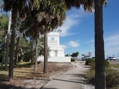
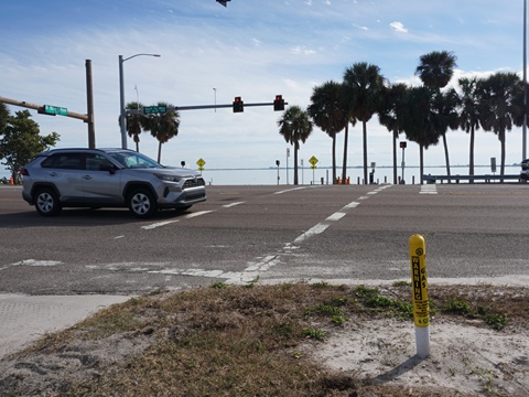
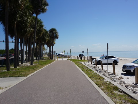
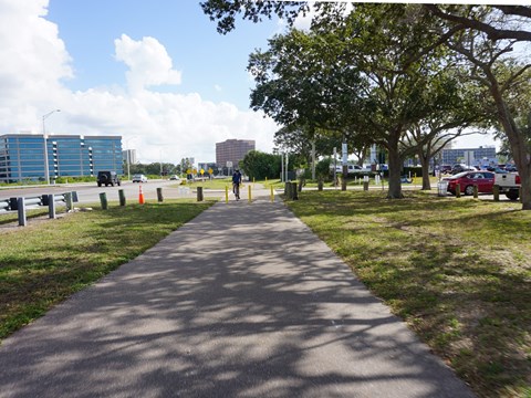
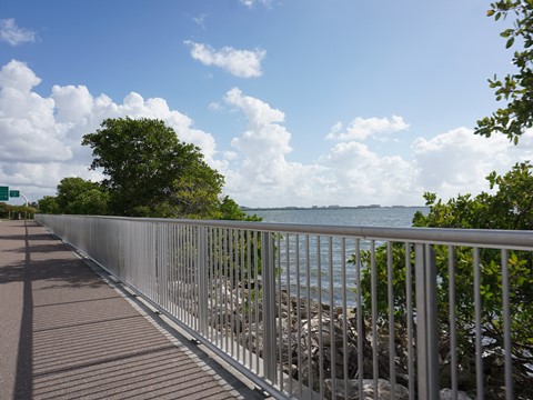
Courtney Campbell Causeway Beach to Main Bridge
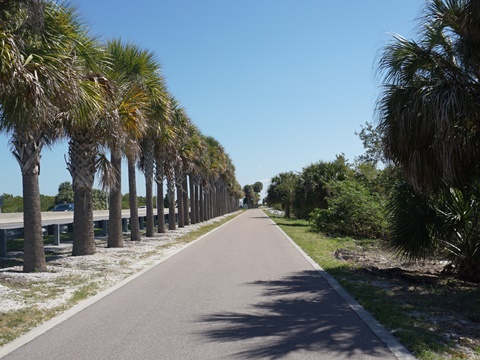
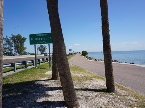
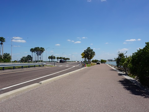
Courtney Campbell Causeway Beach has paid parking but no other amenities. Starting from the beach, The trail continues with views of the Bay and over a short, low bridge (not "the" bridge), then entering Hillsborough County at about mile 4. From here it's another mile to the main bridge. Both counties have done a good job with landscaping along the medians, and while road noise is a constant (affected by wind direction), the views of Old Tampa Bay are well worth it.
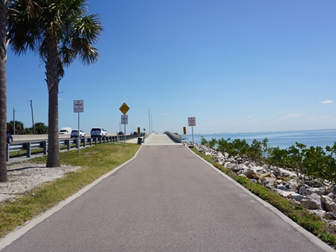
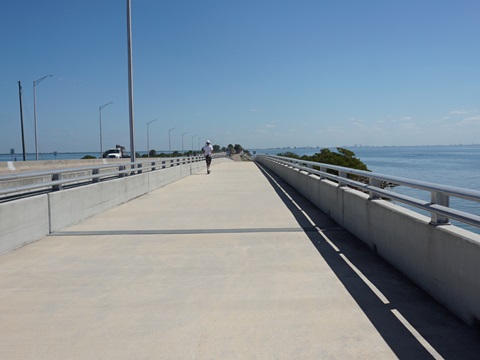
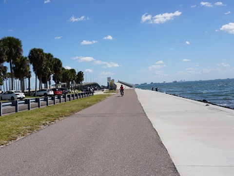
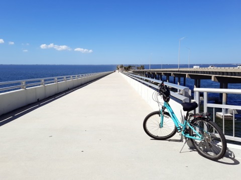
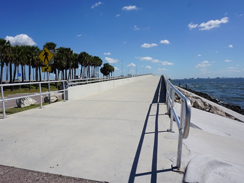
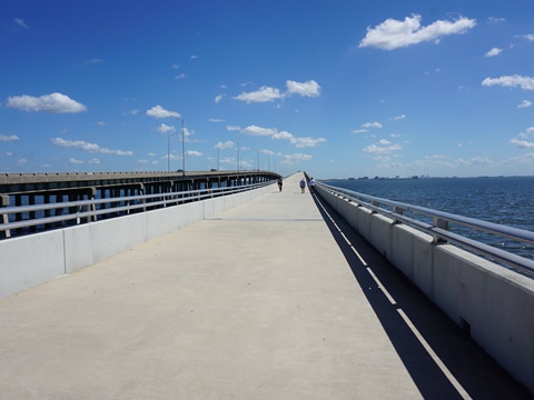
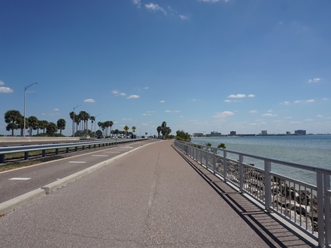
The Main Bridge
The 45-foot-high bridge at about the mid-point of the trail is the highlight of the ride. Many photographers here, with several pull-outs to take in the view. This is the only "hill" on the trail, adding a bit of a challenge, but it's tiered to ease the effort. Free parking is available at both sides, but driving in and then getting back out onto the roadway can be a little tricky (depending on which direction you're coming from, you may have to follow the service road under the causeway to the trail side). We recommend parking at the east side, where there are more entry/exit points, and more parking spaces available. No restrooms that we saw, there are some covered picnic areas and benches nearby.
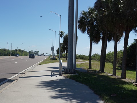
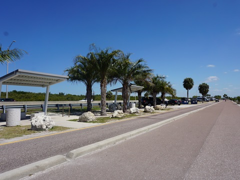
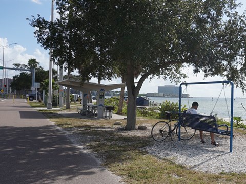
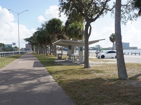
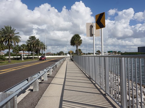
Main Bridge to Ben T. Davis Beach
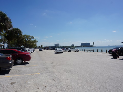
From the bridge, the trail runs next to a service road for almost 2 miles with several parking areas and covered rest/picnic stops along the way providing welcomed shade. The many palm trees and landscaping along the median help mask the roadway. The service road then feeds back onto the main roadway, with the trail continuing bayside another 3/4 mile to Ben T. Davis Beach (fee parking, restrooms, picnic, beach), locally known as a good sunset viewing spot.
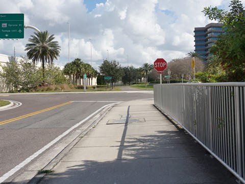
Ben T. Davis Beach to Veterans Highway
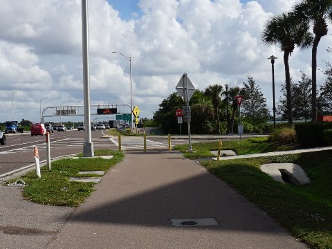
The Courtney Campbell Trail continues 1.8 miles further, ending at Veterans Expressway. Just past the beach is Whiskey Joe's Bar and Grill, a popular stop for food and beverage. From here, the trail runs mostly roadside with some road crossings, through a business area and past the Shriners International Headquarters and Childrens Hospital. Then a long (3/4 mile) boardwalk runs between the road and Bay, with good water views. Courtney Campbell Trail ends at Bayport Drive where it meets Veterans Expressway. Here the trail links to the Skyway Park Trail which runs parallel to the Expressway, 0.7 mile north to Skyway Park sports complex, or 1.3 miles south to Cypress Point Park. These provide additional free parking options for the Causeway Trail.
Some History
The causeway is named for Courtney W. Campbell, a U.S. Representative in the 1950's. Formerly the "Davis Causeway," it was renamed in his honor in 1948 in recognition of his efforts sponsoring its repairs and beautification while he served on the Florida State Road Board. However, the family of Ben T. Davis, owner of a local dredging company who spearheaded the original construction in 1927-34, fought the renaming. His name remains at the Ben T. Davis Beach near the eastern end of the causeway.
More Information and Resources
Nearby Biking:
Bayshore Trail
Ream Wilson Clearwater Trail
Duke Energy Trail
Pinellas Trail
Skyway Park
Trail
Town-n-Country Greenway
West FL Region - More trails
plus Regional Overview map
Related Resources:
City of Clearwater - Courtney Campbell Trail
Tampa
Bay Regional Planning Council - Courtney Campbell Causeway Scenic
Highway Corridor
Find Trails by FL Region or Listed A - Z

100FloridaTrails.com... 100+ Florida Multi-use Bike Trails, Best for Safe, Fun Recreation and Fitness
Other Websites:
BikeOrlando.net
PaddleFlorida.net
BikeTripper.net
Copyright © 100FloridaTrails.com. All Rights Reserved.